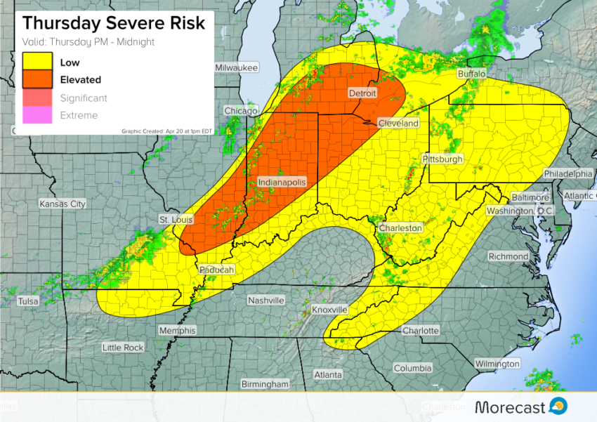
Intensifying storms will produce strong winds and large hail this afternoon through this evening. The risk is greatest from southern Illinois through Indiana into northwestern Ohio and Lower Michigan.
A cold front responsible for severe storms in the Plains on Wednesday afternoon is moving east. Instability building ahead of the front will help strengthen storms through the afternoon. Gusty winds to 65 mph and large hail to 1.5″ will accompany the hotter cells. Major cities like Indianapolis and especially Detroit could be under the gun later today!
We’ll keep monitoring closely and send updates as needed across Twitter and Facebook.