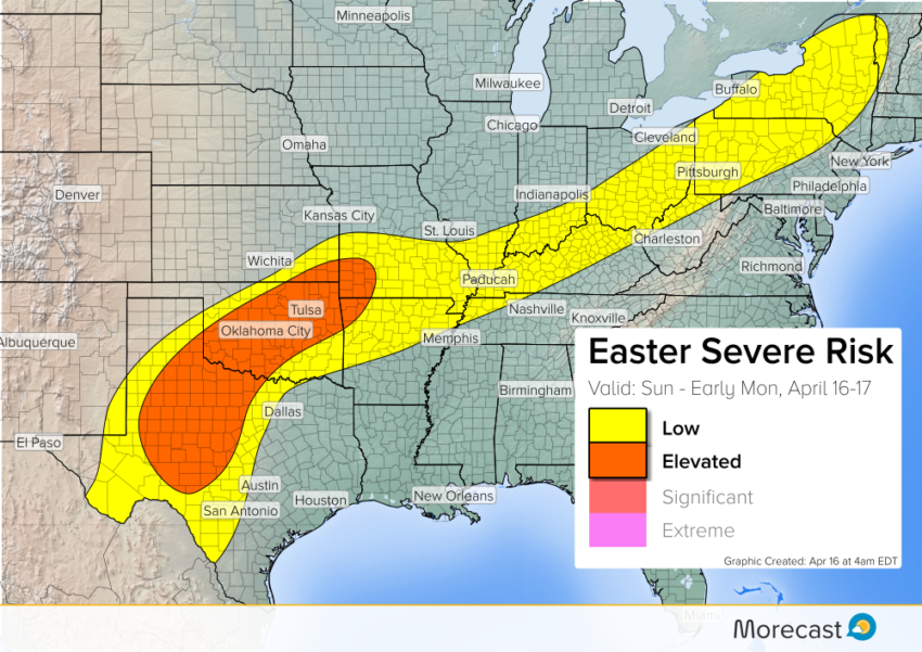
A front will stretch from the Southern Plains through the Ohio Valley into the Northeast today. It will provide enough lift to spark isolated severe storm development. The greatest threat for high winds and large hail will be over northwest Texas and central Oklahoma.
Breakdown:
Upper-level support for organized severe storms is fairly weak along the front. However, it should be sufficient to produce a few potent cells, especially in the Southern Plains where there will be more instability.
Large hail up to 2.5” in diameter and strong winds to 70 mph will be most common hazards. An isolated tornado or two is also possible.
The continuing severe weather follows some impressive storms late last week. Dimmitt, TX saw a huge wedge tornado that luckily stayed mostly in open fields.
Pair of #tornadoes and the #Dimmitt TX wedge. #txwx pic.twitter.com/dq0ws0zrTC
— Sam Dienst (@samdienst) April 15, 2017
We’ll be watching the weather closely throughout the day – keep an eye on our Twitter and Facebook feeds for updates.
Share the forecast on your feed: