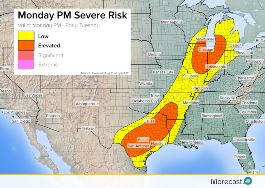
Look for a risk of severe storms later this afternoon into tonight for portions of the Southern Plains as well as the Midwest. Damaging winds and large hail will be common threats with the hotter cells. An isolated tornado can’t be ruled out.
A front moving east will spark scattered storm development from central Texas northeast towards the Great Lakes. There will be two main risk areas. In the Southern Plains, plenty of Gulf moisture will serve as fuel for slow-moving severe storms. High winds to 70 mph and large hail to 1.5″ will occur. Flash flooding will become a major concern this evening.
To the north, widely scattered severe storms will develop from Illinois to southeastern Wisconsin, eventually spreading into Indiana and Michigan. Gusty winds and large hail will accompany the storms here, too. Chicago will be under the gun in the late afternoon and early evening.
We’ll continue to issue updates as needed on Twitter and Facebook. Keep track of severe weather threats to your area with the scrolling ticker on the MoreCast app.