
A significant severe weather outbreak is expected to start off the week across the Southeastern US
A large storm system over the Southern Plains will move into the Midwest on Monday. As it does so, a combination of good upper level support, low level moisture off the Gulf of Mexico, and surface instability will trigger a threat of severe storms across the Southeastern US. The greatest risk of severe storms will be across Southern Mississippi, Southern Alabama, Pan-handle of Florida, and Southwestern Georgia.
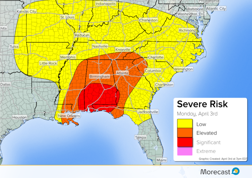
Timing: A line of severe storms will move through Louisiana into Western Mississippi during the overnight hours. Afterward, the storms will continue to move east into Eastern Mississippi, Alabama, and Northwestern Georgia through mid-day Monday. The threat will spread east across Eastern Georgia, Eastern Tennessee, Upstate South Carolina, and parts of Western North Carolina by the evening hours.
Impacts: The main hazards will include large hail up to 2″, wind gusts up to 70 mph, isolated tornadoes, and localized flash flooding.
Follow us on Twitter and Facebook for updates on the severe weather threat. For the latest forecast information, be sure to download the Morecast app.