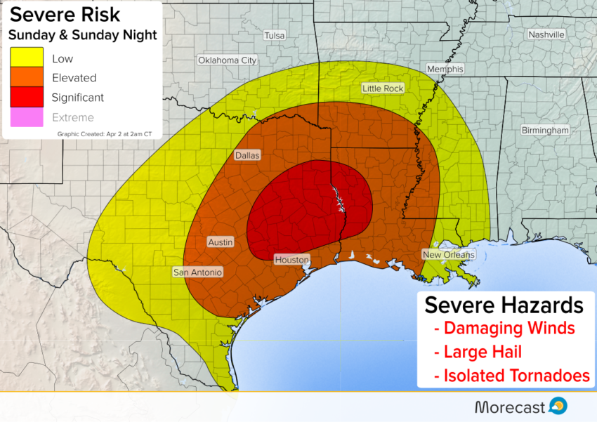
A significant risk for severe thunderstorms is expected across eastern Texas and western Louisiana Sunday.
Significant Severe Weather Risk Sunday
**Updated Sunday 2 pm CT**
Severe storms capable of damaging wind, large hail, and several tornadoes are moving across eastern Texas and Louisiana Sunday afternoon. Flash flooding from heavy rain is also likely in the heavier thunderstorms.
The greatest severe risk into this evening will be across Louisiana and include communities between I-10 and I-20. This include locations along I-49 from Shreveport to Lafayette.
Storms will maintain their fierceness into this evening thanks to the favorable combination of cooler, direr air to the west clashing against warmer, moist air to the east.
Earlier on Sunday, the northern suburbs of Houston as well as the I-35 corridor from San Antonio to Austin and Waco saw severe storms. A wind gust of 68 mph was observed near Austin Sunday morning.
All severe storm hazards will be on the table through the afternoon, including the risk for several tornadoes.
Follow us on Twitter and Facebook for updates on the severe weather threat. For the latest forecast information, be sure to download the Morecast app.