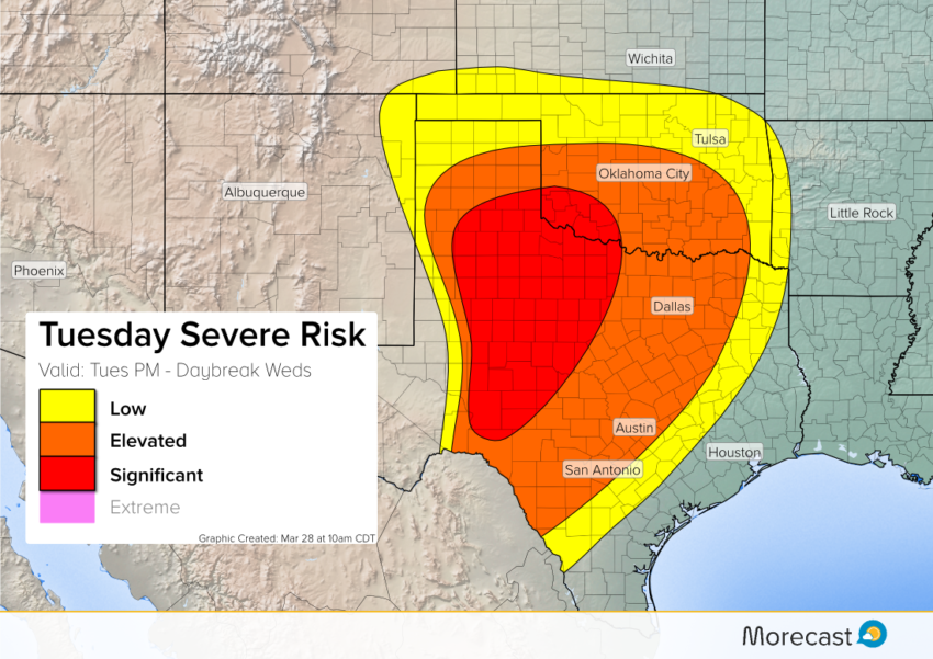
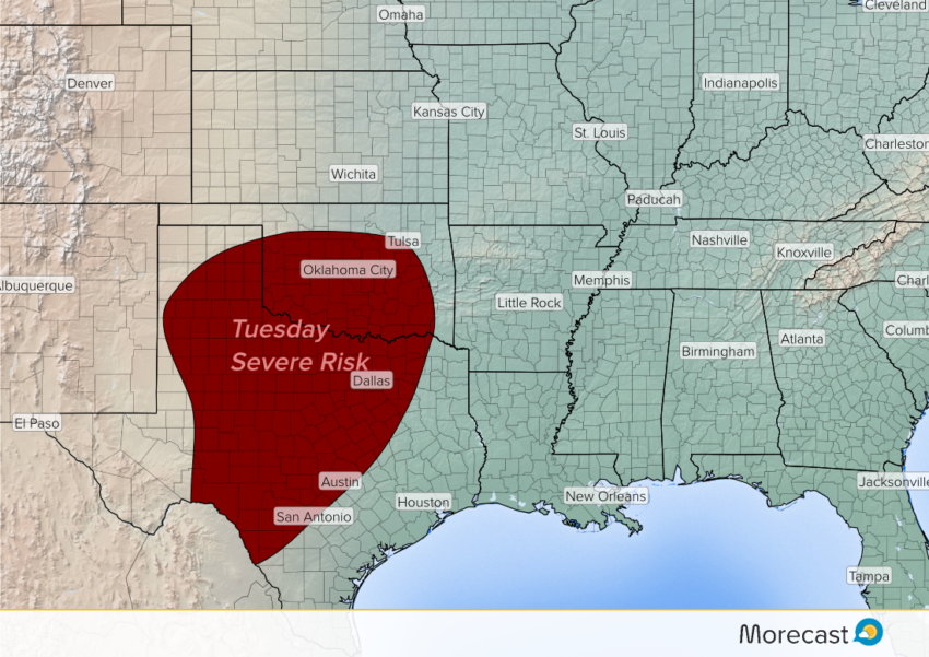
Multiple severe storm episodes will threaten areas of the Plains and Mississippi Valley Tuesday through Thursday. Today’s outbreak will mainly target Texas and Oklahoma. Very large hail, destructive winds, and isolated tornadoes will all be hazards.
Rich Gulf moisture will continue to pool across the South through the next several days. Upper level disturbances will move west-to-east, sparking severe storms, especially during the afternoon and evening hours. Any of these storms will be capable of producing isolated tornadoes, destructive wind gusts to 70+ mph, and very large, damaging hail.
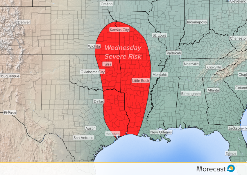
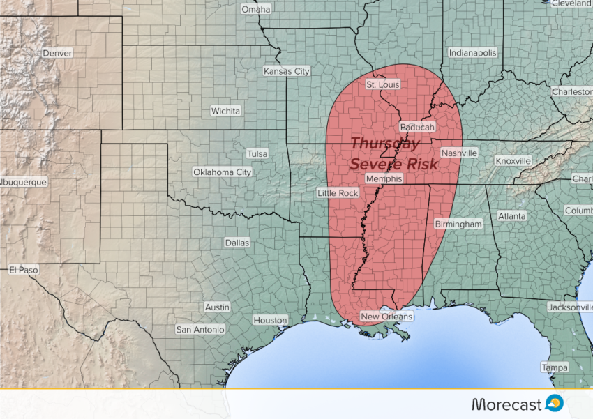
Today’s main threat area will be from west-central Texas into central Oklahoma. For Wednesday afternoon into the overnight, expect severe storms from eastern portions of Texas, Oklahoma and Kansas into Missouri, Louisiana, and Arkansas. By Thursday the severe risk shifts to the Mississippi River Valley.
We’ll continue to issue updates as necessary through the next few days on Twitter and Facebook. The MoreCast app will also have the latest forecast information, including severe updates on the scrolling ticker.