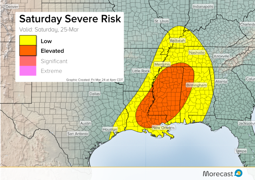
Friday night’s severe storm outbreak should weaken somewhat early Saturday morning. However, the atmosphere will destabilize again on Saturday as the system moves east. Watch for high winds, large hail, and perhaps an isolated tornado or two over parts of the Mid-South on Saturday afternoon and early evening.
A broken band of storms will be crossing the Mississippi River late on Saturday morning. By this time, daytime heating will help feed intensifying storms on the front edge. Damaging wind gusts to 65 mph and large hail to two inches in diameter will be the more common threats. However, isolated tornadoes will be possible in a few of the hottest cells. The storms should weaken after sunset on Saturday evening.
As always, you can find periodic updates as the severe event unfolds on our Twitter and Facebook pages. Stay safe!