
A storm system will push into the Plains later today and During the day Friday, triggering a threat of severe thunderstorms.
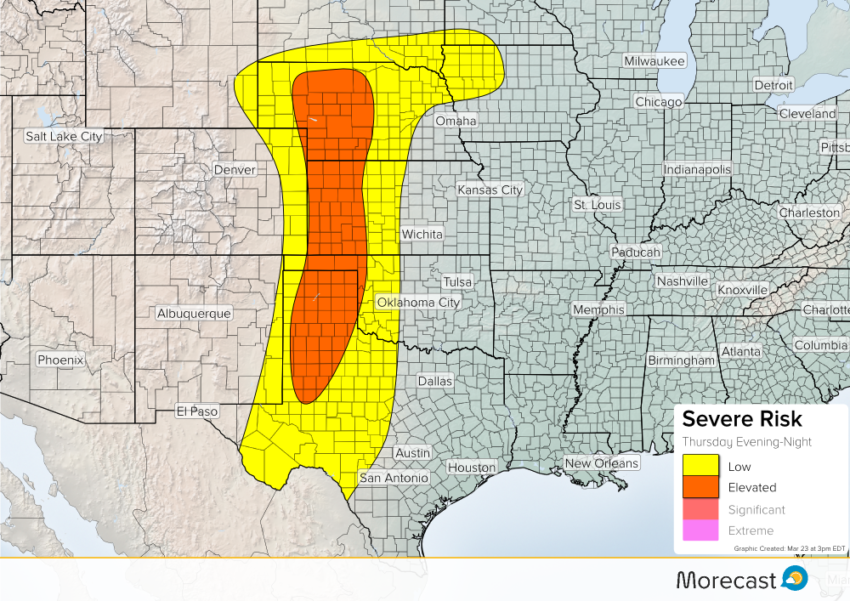
This evening, severe thunderstorms will fire along a trough and warm front over the Pan-Handle of Texas up into Nebraska. Main hazards will include hail up to 1.5″, wind gusts up to 65 mph, isolated tornadoes, and localized flash flooding. These storms will weaken later this evening into the early overnight hours Friday.
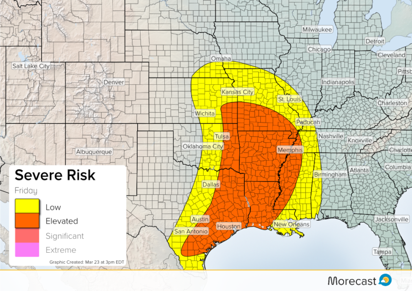
On Friday, a storm system will continue to push east over the Central Plains. Ahead of a cold front, there will be a threat of severe storms across parts of the Southern Plains and Southern US. Storms will develop early Friday afternoon stretching from Eastern Texas up into Kansas. A line of storms will continue to push eastward into the lower Mississippi River Valley Friday evening into the early overnight hours of Saturday. The main hazards will include winds up to 65 mph, hail up to 1.5″, isolated tornadoes, and localized flash flooding.
Follow us on Twitter for more updates on Today’s and Friday’s severe weather threat. If you get a chance, upload your storm photos to the Morecast App!