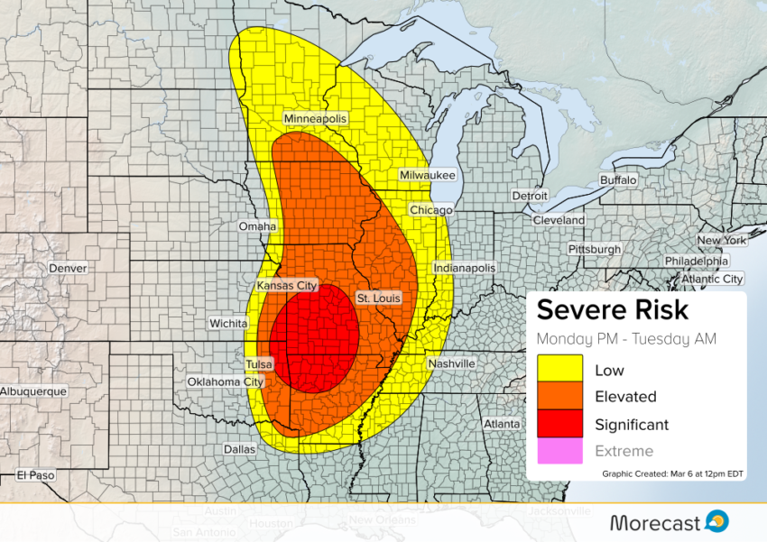
A fast moving system of severe storms will fire up from far north-eastern Texas to Minnesota on Monday afternoon.
The most potent storms will carry a tornado threat across eastern Kansas, northern Arkansas and a good portion of Missouri. The first cells will initiate around late afternoon (CDT) along the KS/MO border, and could be individual supercells. We expect these cells to be absorbed in a fast moving line within two or three hours.
Individual supercells will carry a heightened tornadic risk, though particularly strong and/or long track tornadoes are not expected.
Especially as the line progresses across Missouri, the risk for embedded tornadoes will continue into the early hours of Tuesday.
Further east and in northern areas (Illinois, Iowa, Minnesota), strong wind gusts and hail will be more primary concerns.
Follow us on Twitter for live coverage as Monday and Tuesday’s severe weather evolves. If you get a safe chance, upload your storm photos to the Morecast App!