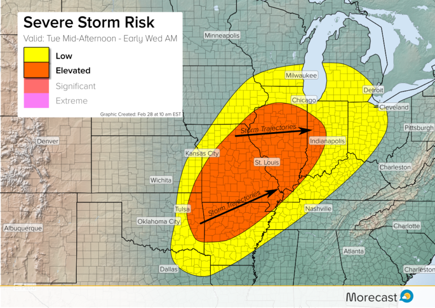
Severe storms are expected to develop by mid- to late afternoon Tuesday over portions of the Missouri Valley and Ozark regions. These storms will spread east and northeast through the evening. Destructive winds, very large hail, and even a couple of isolated tornadoes will occur!
Severe storms will be likely near the Arkansas-Oklahoma border by about 3-4 pm EST. The storms will build north towards the Missouri Valley by early evening. A squall line of concentrated severe storms will sweep east across the Mississippi River overnight.
Wind gusts as high as 80 mph will knock down large branches and even trees, leading to scattered power outages. Hail up to two inches in diameter or locally larger will cause significant damage to cars and roofs. Isolated tornadoes will be particularly dangerous in the evening when visibility is obviously poor. The severe threat will be slow to diminish during the early morning hours on Wednesday.
Another severe storm threat will develop on Wednesday afternoon as the system shifts east. We’ll have more details in the next day or two. Get the latest on our Twitter and Facebook pages as well as the scrolling Breaking News feature of the Morecast app. Stay tuned to your local emergency broadcast source in case severe weather directly threatens you!