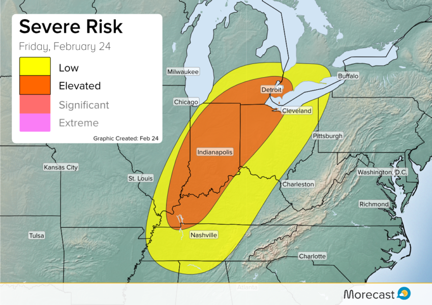
A powerful storm system rolling out of the Plains will bring an early-season severe threat to the Great Lakes and Midwest this afternoon.

Synopsis:
A rapidly developing area of low pressure entering the Midwest is causing headaches for the Great Lakes on Friday. This storm is pulling deep moisture from the Gulf of Mexico allowing for blizzard conditions on its cold side. In the warm region to the southeast of this low, this ample moisture and extreme winds above the ground will lead to a dangerous situation.
Gusty conditions will prevail from Kentucky through Indiana and Michigan today as winds only 1500′ above the ground ramp up to near hurricane force. As the day progresses, numerous thunderstorms will develop along a cold front in eastern Illinois. These storms will rapidly intensify, and work to bring some of those strong winds to the ground.
Hazards:
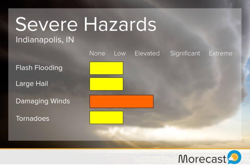
Storms should begin to fire early this afternoon in Illinois. They will then intensify and develop into a line while entering Indiana. The main hazards associated with this line will be very strong winds, though an isolated brief tornado will be possible. Winds gusting to 65 mph will likely be seen from Kentucky through Michigan.
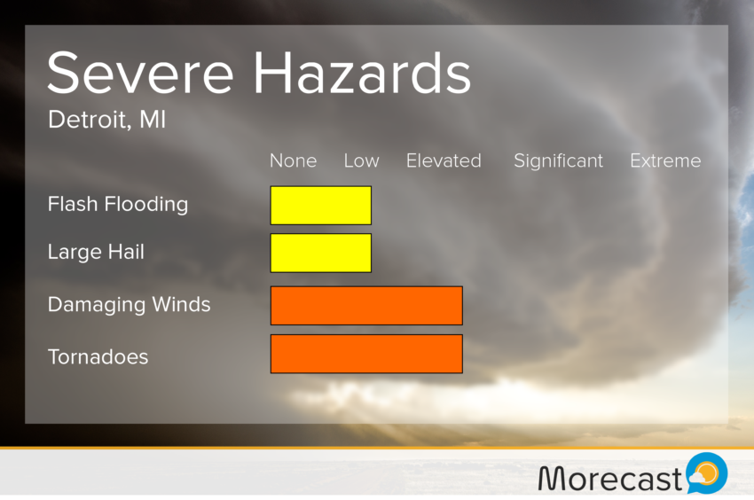
Ahead of this line, there is a potential for isolated supercells to develop. The most likely region to see these will be northeast Indiana, southern Michigan, and western Ohio. Any supercells that develop will see the greatest tornado threat, while maintaining a risk for strong winds.
Friday afternoon’s storms will continue through much of the night, pushing east toward Cleveland. Be sure to stay weather aware as things start to develop. The Morecast team is watching the situation closely, and will keep be bringing you up-to-the-minute updates on our Twitter and Facebook pages.