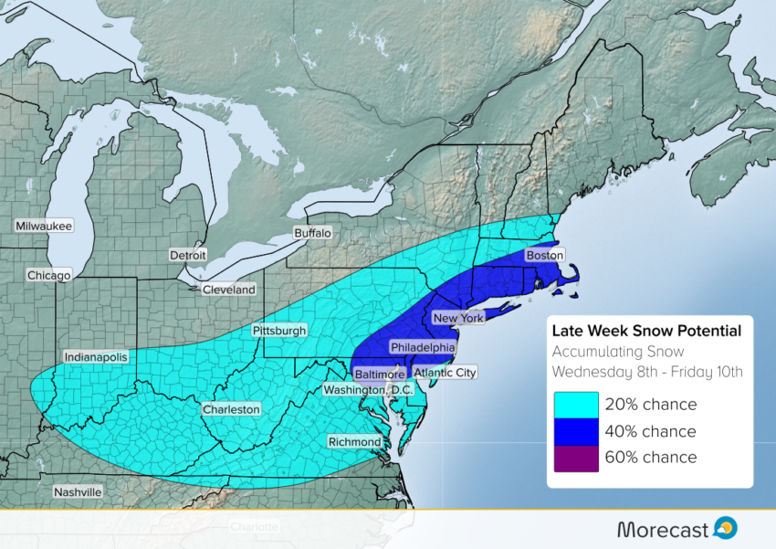
Forecast models continue to hone in on accumulating snowfall across parts of the Northeast and Mid-Atlantic.
A potent piece of energy will swing out of the Midwest on Wednesday, bringing a swathe of snow from Illinois to New England. This energy will develop into a coastal storm as the system pushes into the Mid-Atlantic.
Some nuisance snow is expected from southern Indiana into much of West Virginia and Pennsylvania. As the storm gathers strength, heavier snows look more likely over eastern PA and coastal into coastal state.
Uncertainty over storm track remains a key factor in who will see meaningful snowfall. The current highest snowfall forecasts are split between areas NW of the I-95 corridor, or right along the coast. Over the next day or so, we should see more agreement.
Morecast meteorologists will be providing updates on social media, so stay tuned.