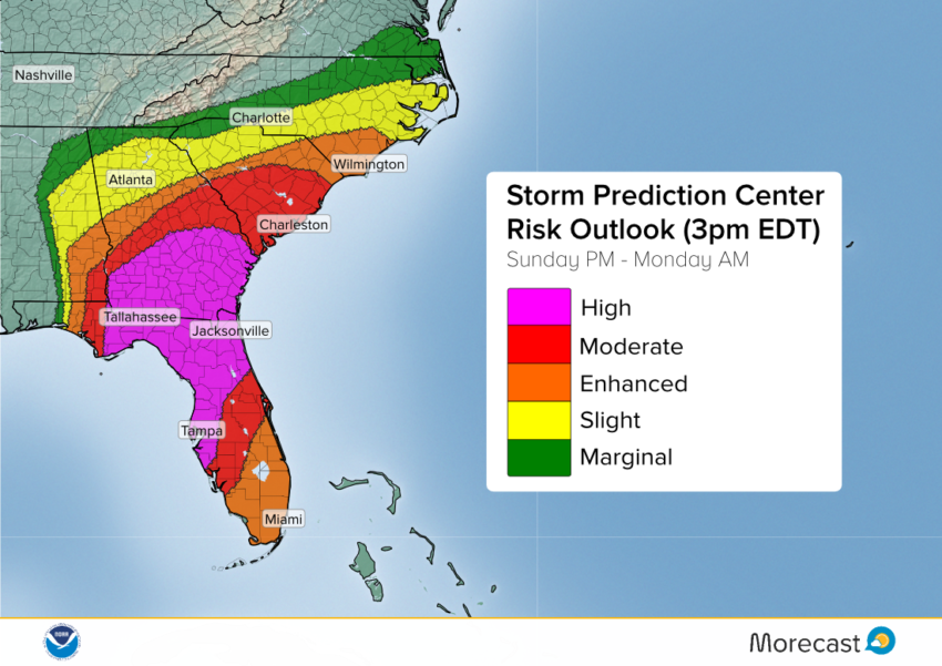
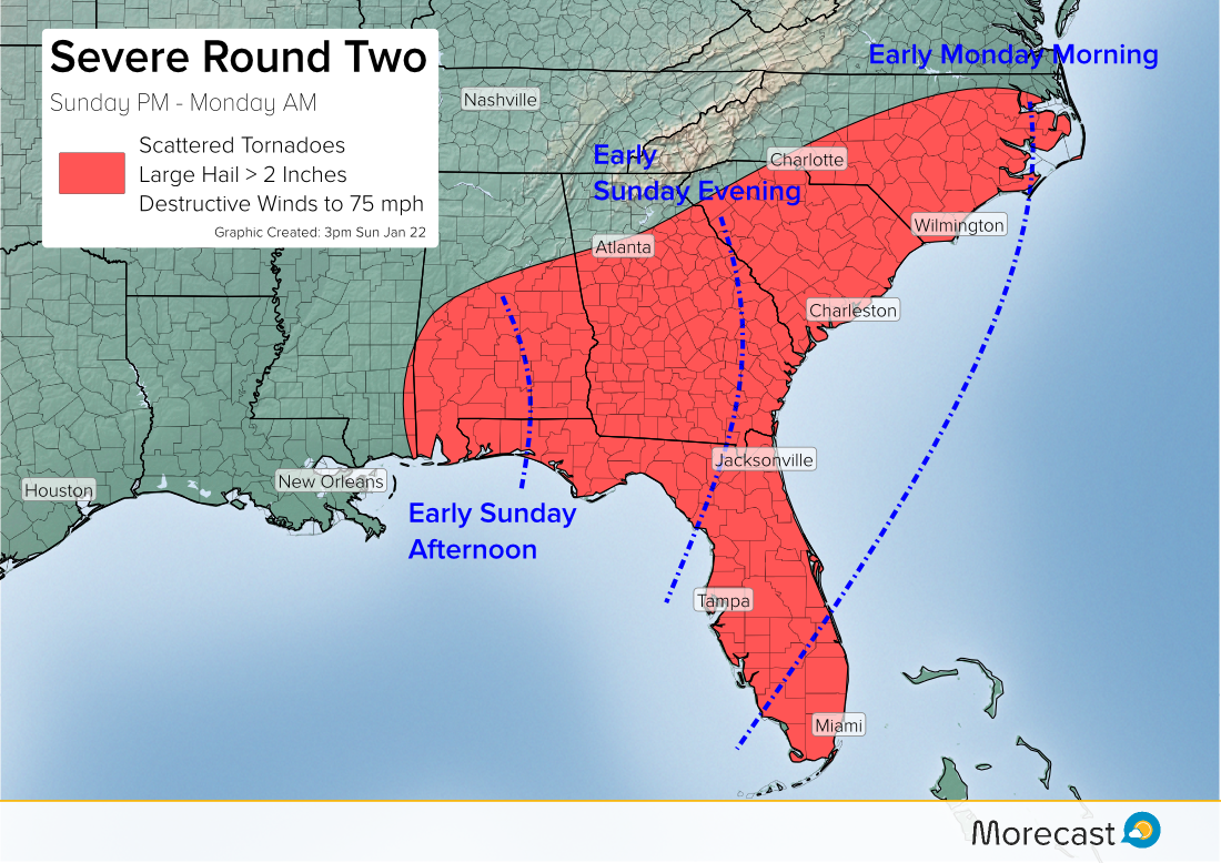
Severe weather with high potential for destructive storms and tornadoes kicked off on Sunday afternoon, and will continue through the evening and overnight.
On Sunday morning, the Storm Prediction Center issued its first “high risk” outlook since June 2014. The last high risk day for tornadoes was a two day outbreak in April 2014. The high risk area was expanded at 3pm and now includes the city of Tampa.
The second and more organized round of severe storms since Saturday morning will target some previously storm stricken areas from Sunday afternoon into early Monday (see below). Another potentially lethal outbreak is expected. Tornadoes, destructive winds to 75 mph, and large hail up to two inches will again accompany the strongest cells.
Even areas of central and southern Florida unaccustomed to organized severe storms will be under the gun by Sunday night. The severe threat will only really diminish towards daybreak Monday.
For the latest updates, keep an eye on our Facebook and Twitter feeds. Check your Morecast app for the latest pinpoint forecast details!