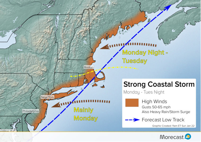

A strong coastal storm will move up the East Coast through early Tuesday. Mild air currently dominating the Northeast will limit wintry precipitation to the interior Northeast. Heavy rain and wind along with localized storm surge could pose some problems for coastal residents, however.
The system brought severe weather to parts of the Southeast on Sunday. Luckily there will be no severe weather threat for the Northeast but wind and rain will impact the area while a wintry mix develops across the interior.
Storm Details
Rain:
Below is Morecast’s own high resolution model that shows how the radar may look from Monday morning through Tuesday morning.
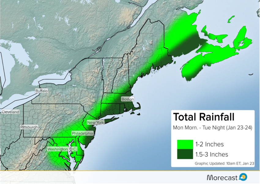
Rain will be pushing into Washington D.C. Monday morning with it reaching Philadelphia and New York by the late afternoon. As low pressure moves to a position just south of Long Island Monday night, the rain will become heavier and continuing spreading up the coast. The storm will move toward the Gulf of Maine on Tuesday before exiting the area on Wednesday.
This system will be fairly quick-moving, but hourly rates could be up to 0.5″/hr, leading to minor urban flooding. The heaviest rains will likely fall along coast from New Jersey up to Maine.

Wind:
Strong easterly winds will accompany the rain near the coast with gusts of 50 to locally 65 mph. Even higher gusts of near 70 mph are likely across the open waters and some of the islands off Cape Cod. This strong onshore flow will lead to a minor storm surge, especially for prone areas and low-lying areas. Beach erosion will be common from the Jersey shore to Long Island and coastal New England.
Wintry Threat:
A mixture of snow and sleet will break out Monday across the northern Mid-Atlantic and expand into interior New England.
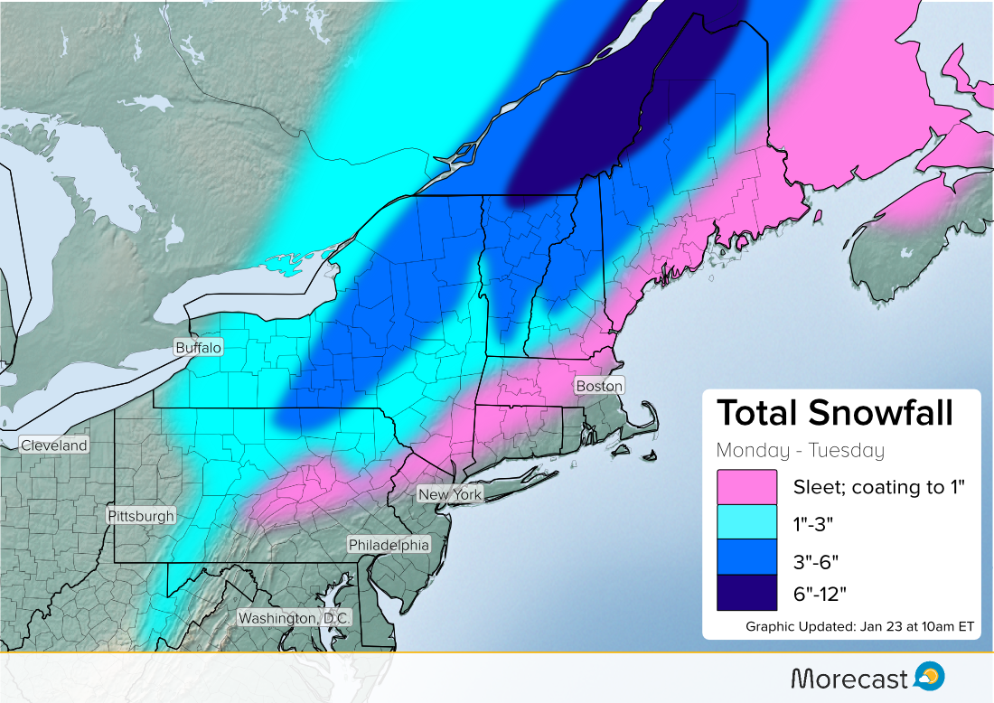
From central Pennsylvania up to the Hudson Valley, interior Massachusetts, and southeastern Maine, the balk of the wintry precipitation will fall as sleet. Farther to the northwest where the atmosphere is colder, a heavy wet snow is expected. The heaviest snow will accumulate in the higher terrain, while lower elevations will tend to switch back and forth between snow, sleet, and rain.
The storm will move away from the Northeast Tuesday night.
Use the Morecast app to get up-to-the-minute forecasts for your locale.