A wintry mix of snow & ice will affect the Northeast Tuesday into Wednesday.
Snow & Ice Details:
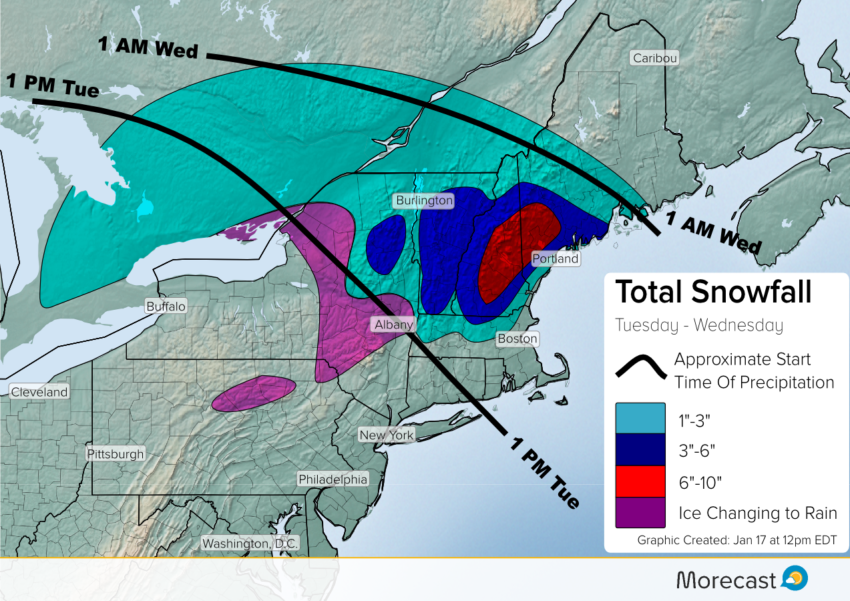
Low pressure will move from the Great Lakes on Tuesday to the southeast New England coast Wednesday bringing a period of snow, sleet, and freezing rain.
The freezing rain that falls across the interior Northeast on Tuesday will generally not amount to much; however, even a light glaze of ice can be hazardous for driving.
Areas of rain fell into a thin layer of subfreezing air across parts of Pennsylvania and New York state overnight Monday into Tuesday morning. The result was freezing rain for some communities.
Pockets of light freezing drizzle could make it slick in parts of the Northeast this a.m. including #Scranton and #Binghamton #PAwx #NYwx pic.twitter.com/vRawHAFLXn
— Morecast USA (@Morecast_USA) January 17, 2017
The precipitation will transition to snow across interior New England during the day Tuesday. More than 6 inches of snow will cover some ski resorts in the Green and White Mountains.
The major cities of the I-95 corridor from Boston to Washington D.C. are expected to receive a cold rain.