After this past weekend’s deluge of flooding rain and snow, another batch of precipitation is bearing into the Golden State. The next round of precipitation will not be as intense as the first, but will still see impressive totals.
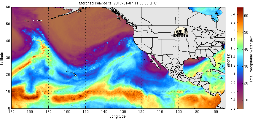
A tropically rooted “Pineapple Express” atmospheric river seen above brought extensive rain/snow to Northern California this past weekend. The bright colors near Hawaii show another round of tropical air on a collision course with the West Coast.
Timing:
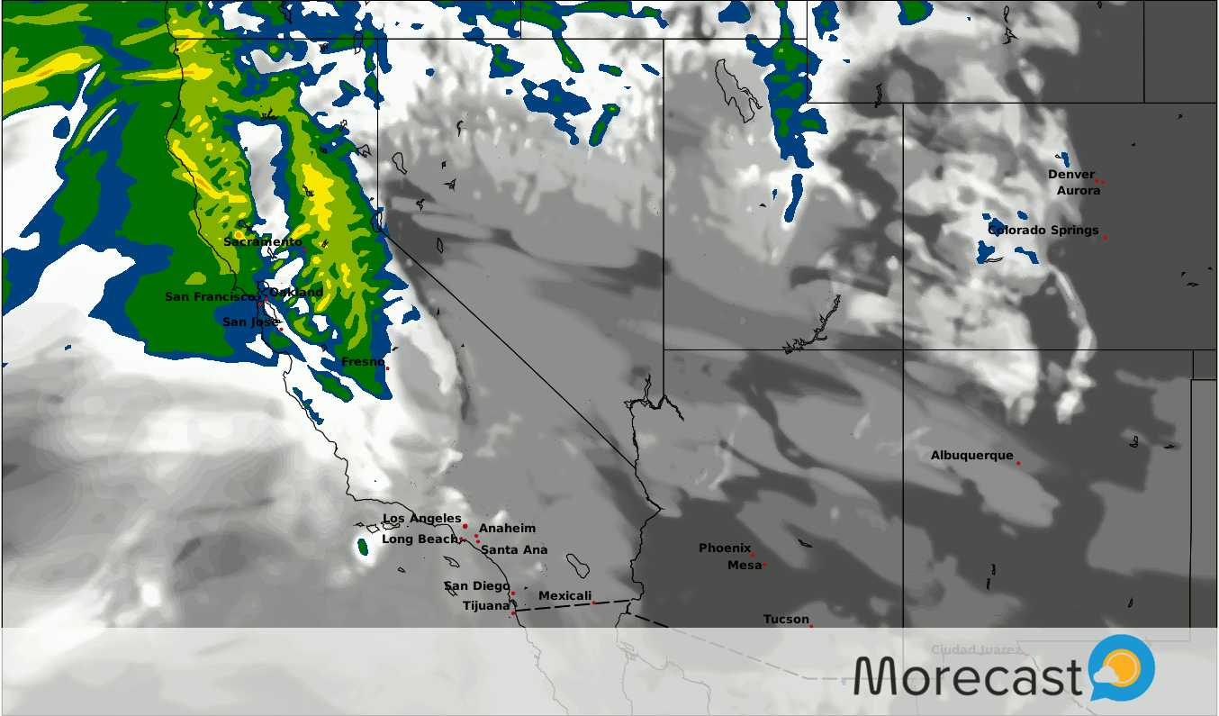
As the forecast radar above shows, the next batch of precipitation will be split into two events. The first is currently ongoing in Northern California, and will start heading down the coast Tuesday evening. Rain should reach Southern California by Wednesday morning with showers persisting in the Sierras to the north. Wednesday night, an additional batch of rain will move into NorCal and quickly head south Thursday.
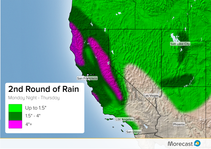
Totals:
Persistent rain along the North Coast will produce impressive totals, with some locations seeing near half a foot of rain. Both rounds of rain will drench the Big Sur region of the Central Coast where an additional 4″-5″ will be possible on top of the 5″-8″ seen over the weekend. The heaviest precip. again will fall in the Sierras. Some locations will double the 6″-10″ of rain seen Saturday and Sunday.
San Francisco and Sacramento may reach the 2″ mark by Thursday. The speed of the rain, and weakening nature will keep totals subdued in SoCal with LA and San Diego possibly seeing half an inch.
This airmass will not be as warm as the last, leading snow levels to fall closer to 6000′. A major benefit from this will be that melting snow will not add to the flooding like in the past event. Ski resorts in the central Sierras will see multiple feet of fresh powder by the end of the week.
Morecast has been monitoring this series of storms all weekend, and will keep you up to date with the latest breaking information and forecasts on our Twitter page.