A pattern of persistent deep moisture will batter the Golden State with precipitation in the coming week. Warm temperatures from the Pacific, combined with few breaks in the torrent, will lead to the possibility for intense flooding and landslides.
Background:
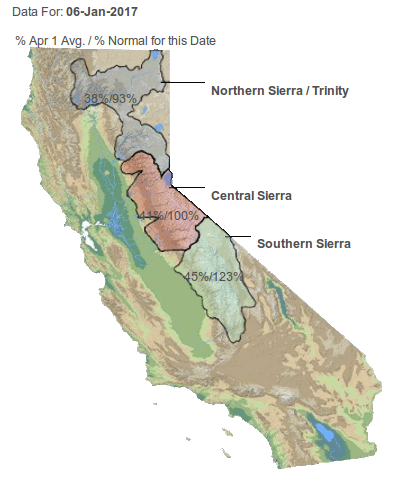
It has been a wet year for the West Coast so far, with California’s Sierra Nevada returning to average. Snow in the mountain range is being measured as low as 5000′ as of Friday afternoon. The cold Canadian airmass that has aided snow at these low elevations will begin to exit while warm air off the Pacific surges inland. As this warm air coincides with heavy rain, much of the snow at lower elevations will begin to melt. Melting snow will combine with impressive rainfall accumulations leading to a dangerous situation.
Forecast:
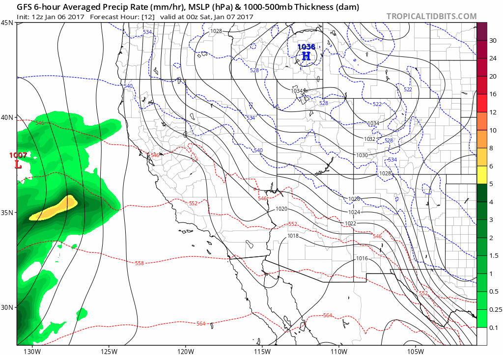
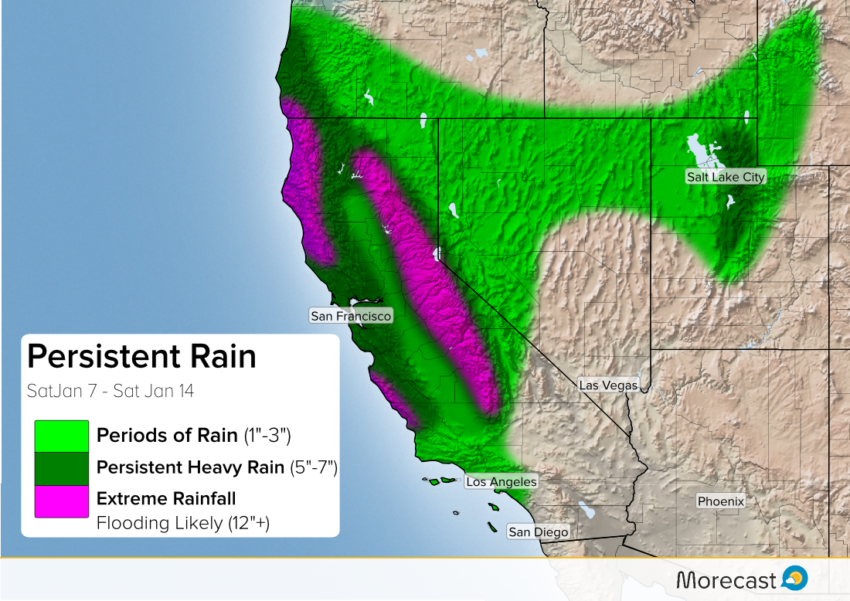
As the animation shows, rain will begin Saturday along the Northern California coast and continue through the upcoming week with little respite. Western slopes of the Coastal Ranges and Sierra Nevada will see the heaviest rain. These mountainous regions will receive half a foot in the coming week, with some flood-prone locations seeing 1-2 feet of rain. The San Francisco Bay area will likely see anywhere from 4″-6″ while Los Angeles may pick up 1″-2″.
As the warm air surges inland, snow levels will rise to 9,000′-10,000′. Above this height, multiple feet of snow will fall. Elevations between 5,000′, where snow is currently on the ground, and 9,000′ will experience significant snowmelt.
Hazards:
Flooding will be a large threat with the train of storms approaching. Prolonged heavy rain will lead to extensive street and river flooding, especially near coastal and mountain communities. Additionally, mountainous locations in far northern California, along Big Sur, and the western Sierra Nevada will be at risk for landslides. The average snow pack in the Sierra Nevada, when melted, can act as an additional 10″ of rain in the lower elevations! Combining this melting snow with rain totals that can easily exceed a foot, intense flooding will be possible. Flooding may even extend into the Central Valley as rivers swell from runoff.
This prolonged rain event will be somewhat unusual for California. The Morecast team will be monitoring the situation, and will be pushing updates to our Twitter and Facebook pages.