Cold air settling into the Mid-Atlantic and Northeast will set the stage for a quick-hitting snow event into Friday.
The Details:
A fast moving disturbance will eject eastward from the Central Plains on Thursday. Consequently, a shield of light snow will spread eastward from the Ohio Valley into the Northeast Thursday night and early Friday.
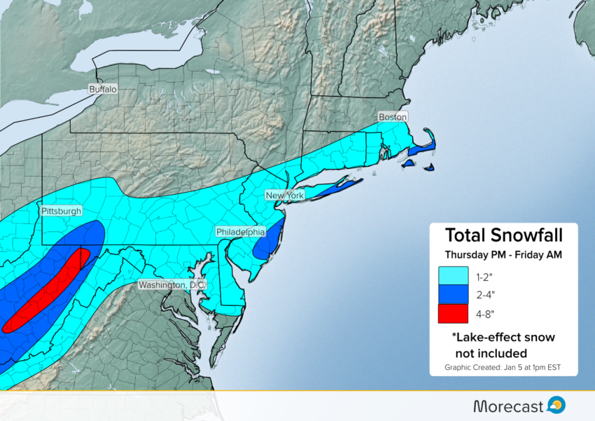
After bringing a couple of inches of accumulation to portions of the Central U.S., a half-foot of snow is likely across the higher terrain of the Appalachians. Farther east, a general 1-2 inches is expected over the northern Mid-Atlantic and southern New England. However, as the disturbance reaches the East Coast it will tap into enough Atlantic moisture for a swath of 2-4 inches of snow from New Jersey to Nantucket.
While accumulations will remain generally light, the cold temperatures preceding the storm will increase the chances for slippery roads. For cities like Philadelphia, New York, and Boston, the Friday morning commute may be slower due to the wintry weather.