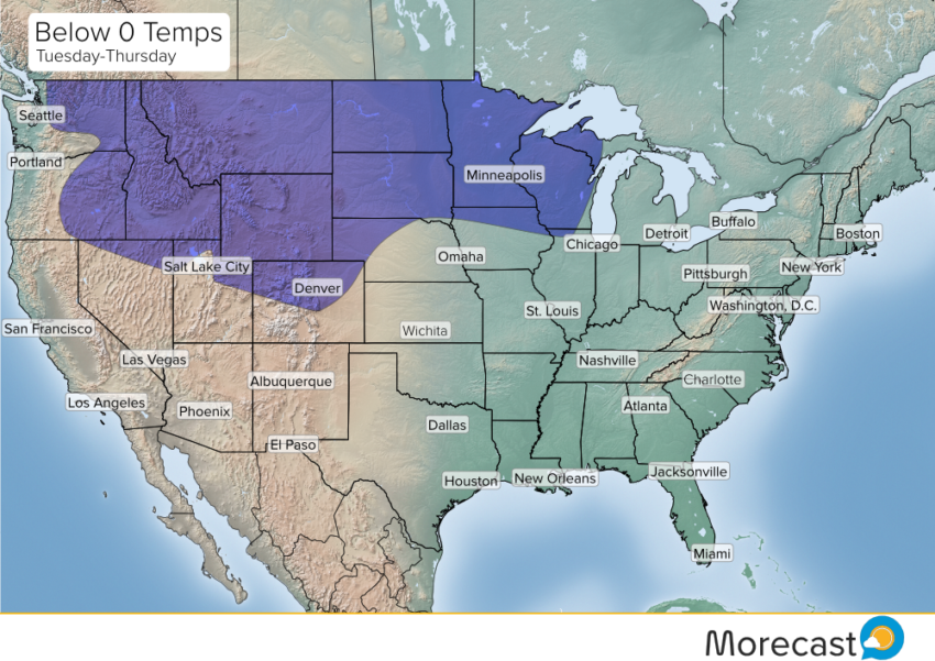
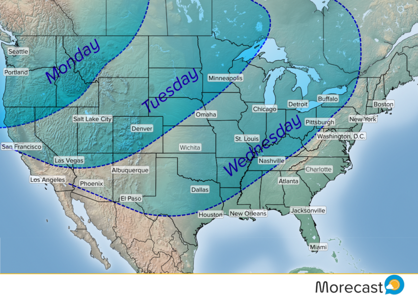
A major Arctic air mass is loading up over western Canada and will be sliding down into the Pacific Northwest on Monday. By mid-week, the frigid air will be spreading east across much of the Lower 48.
Record cold temperatures will be in danger for many areas. Not only that, but the cold air mass will be locked in place for an extended period. Some portions of the Northern Plains and Upper Midwest will remain below zero for several days if not a week or more. Lows will be well below -20 deg F, even -30 deg F on a few nights.
The extent of the cold air could mean a threat for light wintry precipitation for areas somewhat unaccustomed to it. For instance, light snows or wintry mix could affect coastal portions of the Pacific Northwest, including Portland and Seattle. Portions of the central or southern Plains could also be in danger of seeing light wintry accumulations. For more details on temperatures and precipitation chances customized for your location, consult the Morecast app!