
(Updated Sunday morning, 12/25)
A significant winter storm is moving into the Plains Christmas Day threatening to bring a potpourri of weather. Rain, thunderstorms, freezing rain, snow, and even blizzard conditions will have major impacts on travel for many from California to Minnesota.
Christmas Day Storm Details:
Already on Christmas morning, low pressure had deepened quickly just east of the Rocky Mountains. Gusty thunderstorms erupted in Colorado early Sunday morning and raced into the central High Plains.
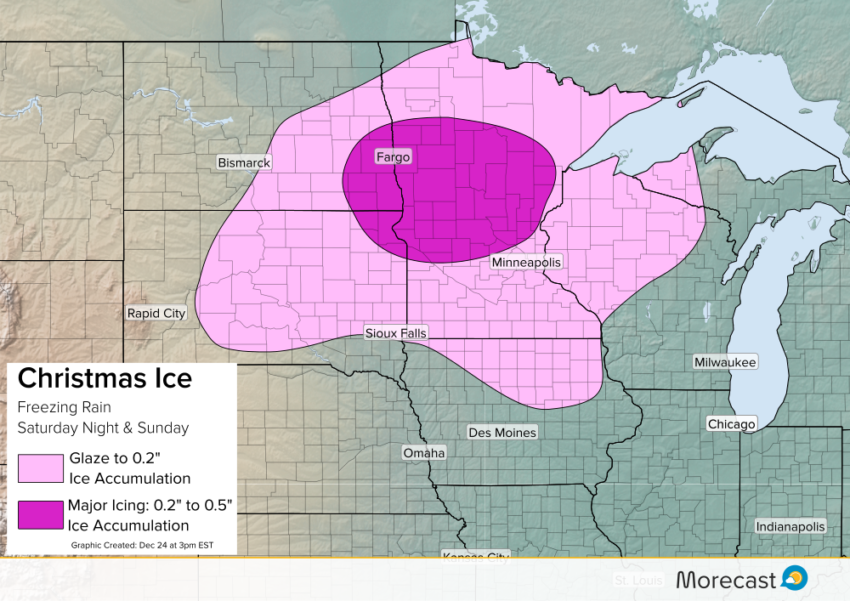
Significant icing is likely Christmas Day across the Dakotas and central Minnesota as freezing rain is expected, coating roads, trees and power lines in ice for places such as Fargo and St. Cloud. The Twin Cities along with southern Minnesota, northern Wisconsin and northern Iowa will also have to contend with some freezing drizzle Christmas morning and afternoon, but will switch to a cold rain by Christmas night as temperatures at the ground level climb above the freezing mark.
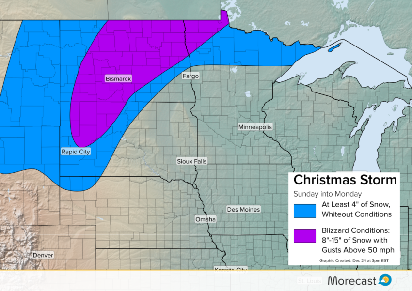
Meanwhile, the storm will turn into a full fledged blizzard over most of North Dakota and the western half of South Dakota by Christmas Night. Snow accumulations over a foot will combine with powerful winds in excess of 50 mph leading to white out conditions. Travel is likely to become impossible in many spots, including on I-90 and I-94, so those living in these areas should prepare to hunker down until the storm moves out Monday afternoon.
Storm History:
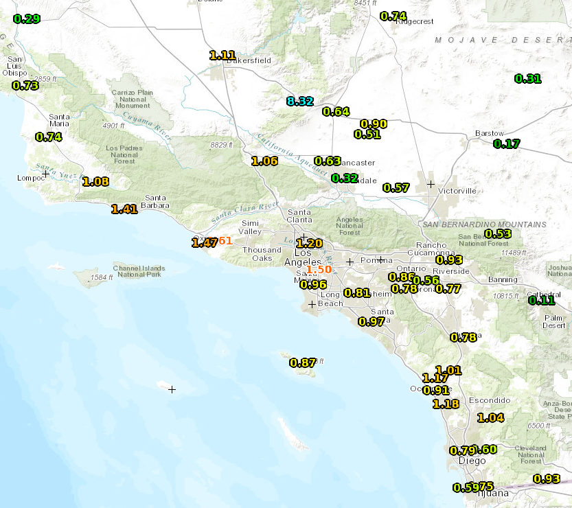
Prior to affecting the Plains, the storm brought its first impacts to the West. Beneficial rain fell along the I-5 corridor in California Friday evening and night. In fact, several locations in and around drought stricken Los Angeles recorded between one and two inches of rain.
Meanwhile, it was a Winter Wonderland across the Sierras, where several locations picked up between 10 and 18 inches of heavy snow, making travel over the passes treacherous, but bringing fresh powder to the several ski resorts that are packed for the holiday weekend.
Fresh powder makes for a white #Christmas in the mountains this year! Here’s a look at storm total snow reports so far! #cawx pic.twitter.com/dCK5QMMzot
— NWS Sacramento (@NWSSacramento) December 24, 2016
Across the Intermountain West, rain in Salt Lake City, Utah on Christmas Eve changed to snow overnight. Several inches of snow accumulated by Christmas morning granting the wishes of those who were looking for a true white Christmas.
The Morecast team will be monitoring the storm through this weekend with updates on our Twitter and Facebook pages. Have a Merry Christmas and stay safe where the weather gets nasty!