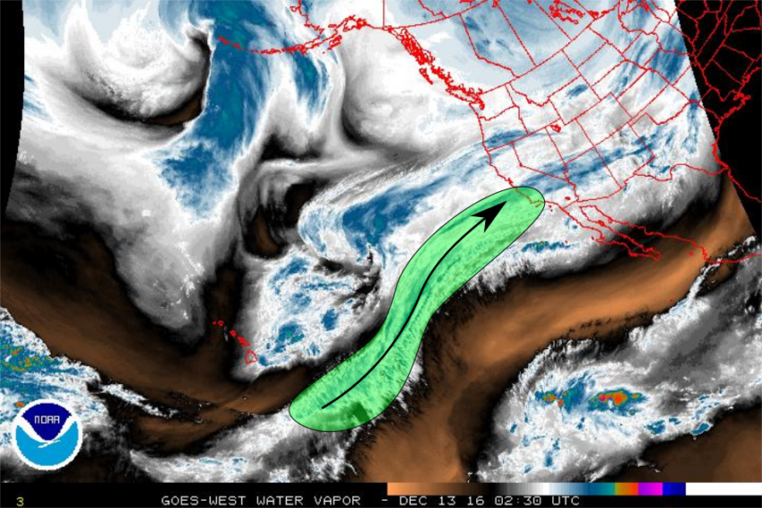
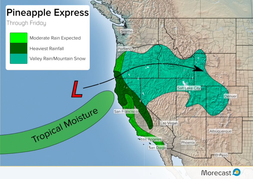
A series of storms will roll into the Western US this week. With each storm, a “Pineapple Express” moisture plume rooted near Hawaii will allow for heavy rainfall and mountain snow.
![]()
Storm One:
The first round will be confined to Northern California and southern Oregon where rain and mountain snow will begin Tuesday afternoon. Snow levels will start off around 6,000′ before lifting to above 7000′ as warmer air filters into the region. Snowfall amounts of 1-2 feet are possible for the highest and most exposed slopes.
Rainfall may total 1″-2″ at lower elevations, specifically areas north of San Francisco and Sacramento.
Further east into Nevada and Idaho, snow level will generally hover 5000′ Wednesday and rise closer to 6000′ Thursday. Higher elevations in these parts will also see around a foot of snowfall.
Storm Two:
Following along the heels of the first rainmaker, the second Pacific storm will roll toward the coast Wednesday night. This storm will be more widespread, and bring rain and snow from southern Oregon to Southern California.
A richer moisture supply will accompany this second storm, bringing heavier rain, gusty winds, and mountain snow. Snow levels over California and Oregon will start off high, before dropping down to 5000′-6000′ on Friday. An additional 1-2 feet is possible by the end of the day Friday for the highest elevations.
In lower elevations, rainfall amounts of 1-2+ inches are likely again, especially north of San Francisco and Sacramento. The Bay Area, Sacramento, and the L.A. Basin can expect to see 0.5″-1″ from this event. Low snow levels means that the mountains of L.A. County may see a couple inches of powder by the weekend.
Widespread snow showers are expected as far east as Colorado as this storm rolls inland. With low snow levels, cities such as Salt Lake may see 5-8″ late this week.
Travel disruptions will be likely this week in both the air and roadways as these storms batter the Pacific Coast. If planning to drive over the mountain passes, please make sure to give yourself extra time and be prepared to place chains on the tires. In addition, strong wind gusts primarily on the coast and across higher elevations of Central California could produce scattered power outages with the cold front on Thursday.
The Morecast team will be monitoring the storm and will send updates through our Twitter and Facebook pages. Be sure to check the Morecast app for a hyper-local look at exactly how much rain you can expect to see!