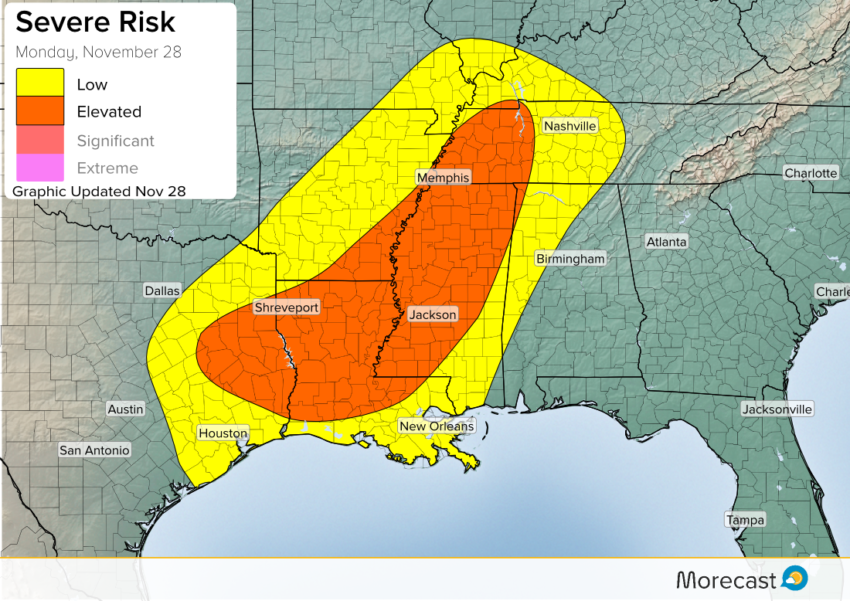
(Updated 9 a.m. Monday, November 28)
A strong, large November storm is developing across the central United States. On the northern flank, heavy snow is falling in the Dakotas, while severe storms are anticipated later Monday on the storm’s southern flank in places such as Louisiana, Arkansas, Mississippi, and Tennessee.
Setup:
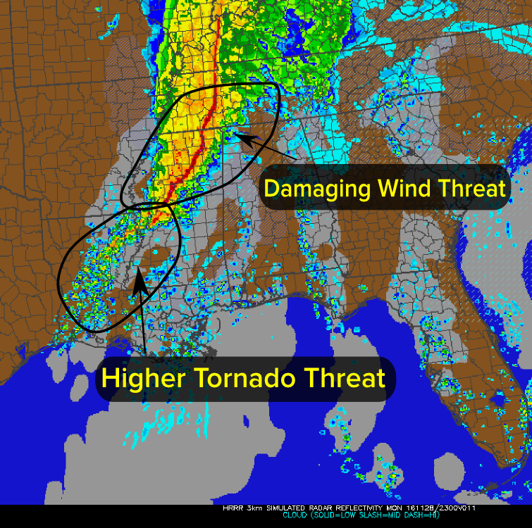
The strong storm in the Northern Plains is leading to strong winds a few thousand feet above the ground across much of the central US. These winds will easily exceed 100 mph at 10,000-15,000 feet. The strong southerly winds will also pump in rich moisture from the Gulf, and heavy rain was already falling across parts of eastern Texas and Oklahoma as well as Arkansas Monday morning. Along with heavy rains, the intense winds will make it possible for a strong line of storms to develop Monday afternoon and evening as the cold front pushes eastward. This line will use the strong winds aloft to bring the risk for damaging winds and flash flooding from Missouri through Arkansas, Mississippi and Tennessee. Additionally in this line, a brief tornado will be possible, but the damaging winds will remain the primary threat. Along the southern edge, from southeast Texas through southern Mississippi, more isolated thunderstorms will develop. These intense, individual storms will bring strong winds and a better chance for some tornadoes compared to the long line of storms to the north.
Timing:
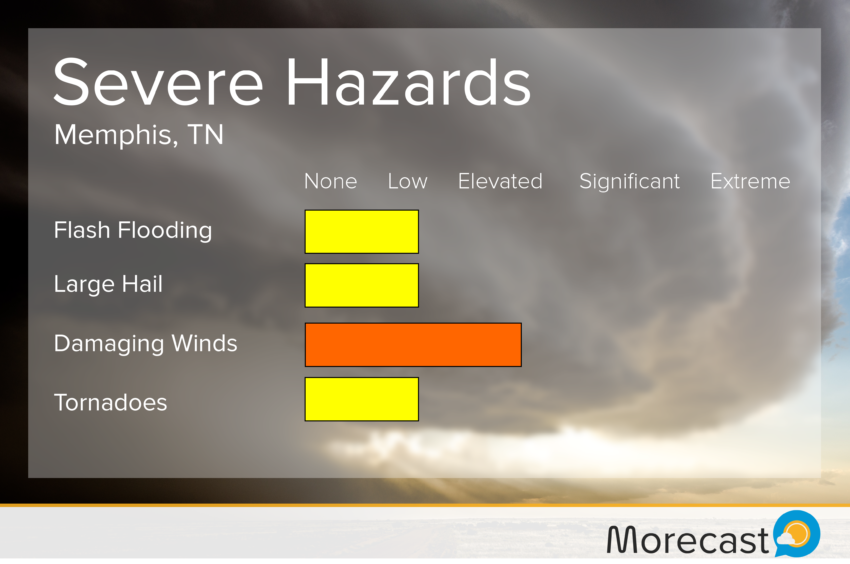
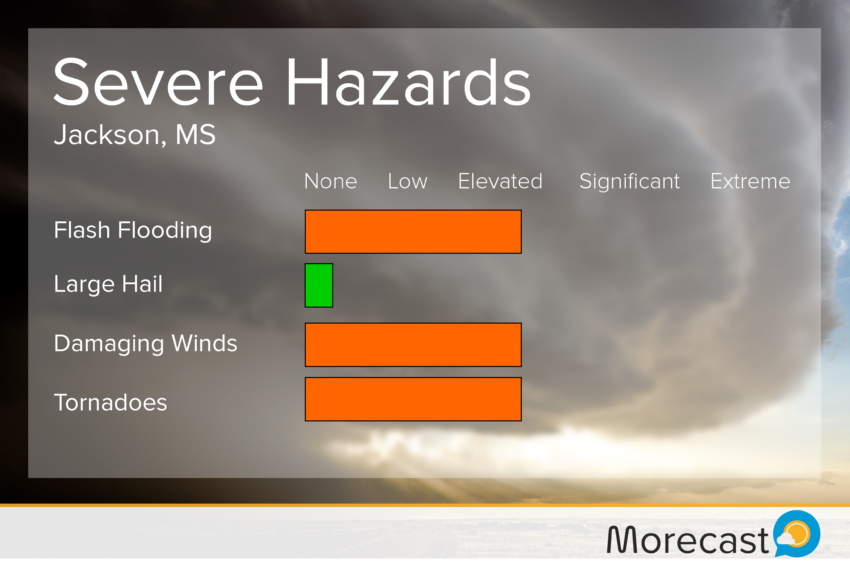
The threat for tornadic storms will begin to increase across northern Louisiana by the mid-afternoon hours, continuing into Monday evening, when the threat will also increase for portions of southern Mississippi as well. Meanwhile, the widespread rain and thunderstorms across Arkansas will begin to form into a squall line after 2 p.m. (CDT) along the Mississippi River, pushing into western Tennessee and northern Mississippi. These wind producing storms will continue to slice eastward, possibly maintaining some strong, windy storms into Monday night all the way into northern Alabama.
See the graphics below for the threats affecting the three metros in the severe threat zone:

The Morecast team is closely monitoring this developing situation and will be keeping you up to date as it progresses. Be sure to follow along with us on our Twitter and Facebook pages. For a more in depth look at when you can expect these storms in your neighborhood be sure to consult the Morecast app on iOS and Android.