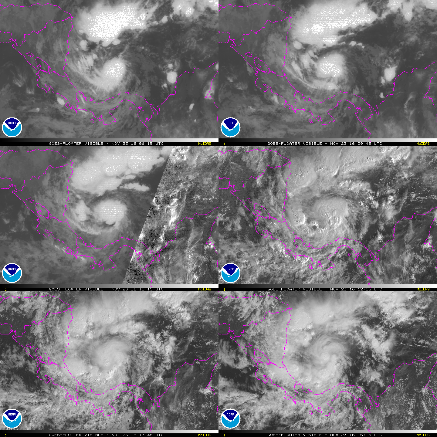
2016 has been an unusual year for the tropical Atlantic. It’s been 10 months since the first hurricane of the season formed, and over a month since Nicole dissipated. Then came Otto, a particularly unusal storm
Track Forecast:

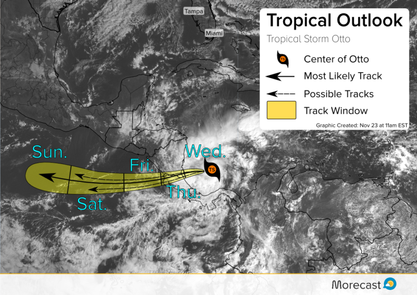
Otto is currently spinning in the Caribbean off the coasts of Nicaragua and Costa Rica. The storm is currently (as of 11am Wednesday) a high-end Tropical Storm with winds to 70 mph (110 km/h). With warm seas, and an overall favorable environment, Otto should restrengthen to a hurricane this afternoon. Conditions will deteriorate overnight with landfall likely early Thursday along the Costa Rica and Nicaragua coast at borderline hurricane strength. After landfall, the storm will cross Central America and exit into the Pacific. Unfavorable water temperatures and dry air should spell the demise of this late-season storm.
Freak Storm?
Otto formed as the ninth latest hurricane on record, becoming a hurricane November 22. The most recent storm to form after this date was Hurricane Epsilon in 2005. Of those nine late season hurricanes, only 1969’s Hurricane Martha formed in this region of the western Caribbean with most forming in the open Atlantic. The track of Otto places it very close to the Costa Rican and Nicaraguan border at landfall. With records dating to before the U.S. Civil War, the Caribbean cost of Costa Rica has only been hit by one tropical storm and never by a hurricane. The lone tropical storm was unnamed since the tropical system naming convention didn’t exist back in 1887 when the storm made landfall. If Otto tracks just a few miles south and strikes Costa Rica, it will be the first hurricane in recorded history to do so.
2016 started the year with the second earliest hurricane on record when Alex formed in mid-January. Now, 10 months later, we’re continuing to discuss abnormal cyclone developments with Otto as the season winds down. Be sure to keep up to date with the latest developments with this storm by following the Morecast team on Twitter and Facebook.
