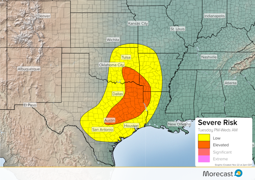
A cold front will be moving east across the Southern Plains this evening into the overnight. A combination of a mid level trough, surface instability, and nocturnal jet will trigger the potential for severe storms.
An elevated area of severe storms is possible this evening into the overnight. Storms will begin to fire this evening, as upper level energy and surface instability will aid in storm development. These storms could produce hail up to 1″, wind gusts up to 70 mph, isolated tornadoes, and localized flash flooding.
Thunderstorms will roughly develop between 6-9 PM CDT. Major cities affected include Austin, Texas; Waco, Texas; and Tyler, Texas.