A strong storm in the Pacific is tapping into rich tropical moisture. The storm’s cold front has shifted into northern California and is being accompanied by heavy precipitation. This frontal band is being enhanced by favorable terrain over northern California, resulting in flooding rains and heavy mountain snows.
This storm’s center of low pressure is still offshore, and will stay offshore as it dissipates in the coming days. The cold front extending from this low, however, will remain draped through Northern California and Oregon. A broad area of rain followed the front into NorCal overnight. Many parts of Sonoma and Mendocino counties saw over an inch of rain with closer to three inches falling in Santa Rosa. In the Sacramento Valley, close to an inch has fallen through midday Saturday with rain still falling in the state’s Capital.
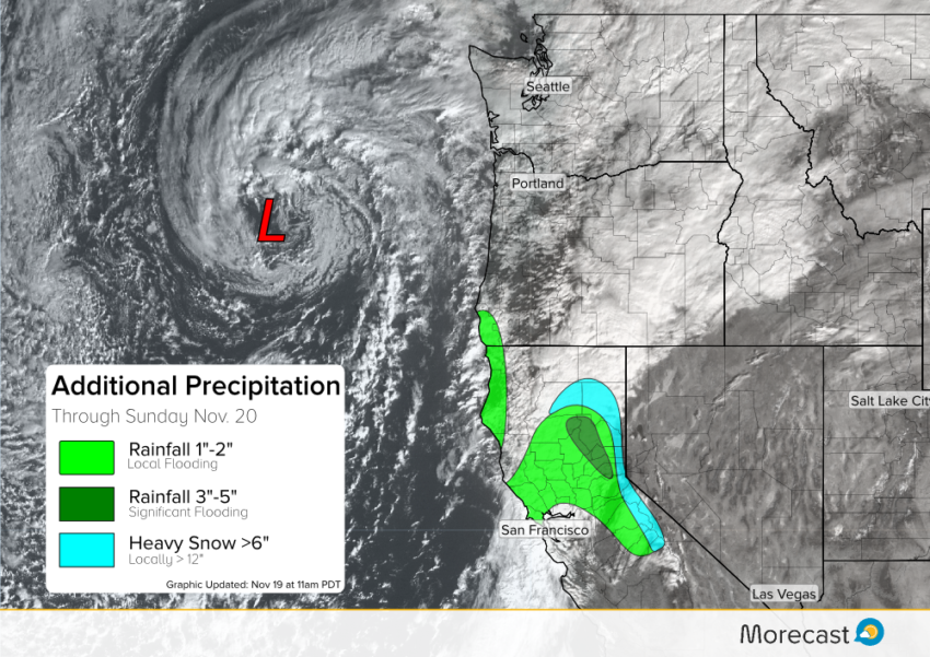
Moving forward, an additional inch of rain is possible around the San Francisco Bay. Exposed western slopes of the Coastal Ranges will see the heaviest rain in the Bay Area. Further east, heavier rain will persist in the south and west facing slopes of the Sierra. The rain shield will begin to ease off later Saturday with spotty showers continuing through Sunday. Be mindful driving, especially around the mountains this weekend as significant flooding with mudslides are possible along travel routes.
Snow levels have fallen to four to six thousand feet, allowing significant accumulations in the higher elevations. The highest peaks will see accumulations easily exceed a foot or two. Snow will be mixed with rain closer to 4,000 feet in elevation, but total accumulations could still approach six inches or so. Winds will also pick up, leading to blizzard-like conditions at the highest elevations.
Stay tuned to our Twitter and Facebook pages for additional forecast updates as needed. You can also consult the Morecast app for pinpoint temperature and precipitation forecasts for your locale or travel destination!