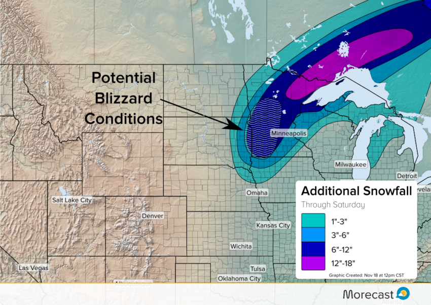
The first major winter storm of the season continues to bring snow and strong winds to the Upper Midwest into Saturday. Blizzard conditions will persist in portions of Minnesota and the Dakotas throughout Friday. Snow totals will likely reach over 12 inches of snow under the system’s heaviest snow bands.
Snow Threat:
As the surface low intensifies in the Upper Midwest, a band of heavy snowfall has developed. The heaviest bands will potentially drop over a foot in some locations into Saturday. Additional snowfall in the Dakotas, Nebraska, and Iowa will be near 1 to 3 inches. The majority of Minnesota can expect anywhere from 6 to over 12 inches of snow. However, the heaviest snow will occur in northeastern Minnesota. In addition, Wisconsin and Michigan will receive some lake-effect snow, with Wisconsin seeing a greater chance of heavy snow near the lake. Strong winds from the intensifying low has caused blizzard like conditions from South Dakota through northern Minnesota. The National Weather Service has issued a blizzard warning for northeast South Dakota and western Minnesota, ending Friday evening.
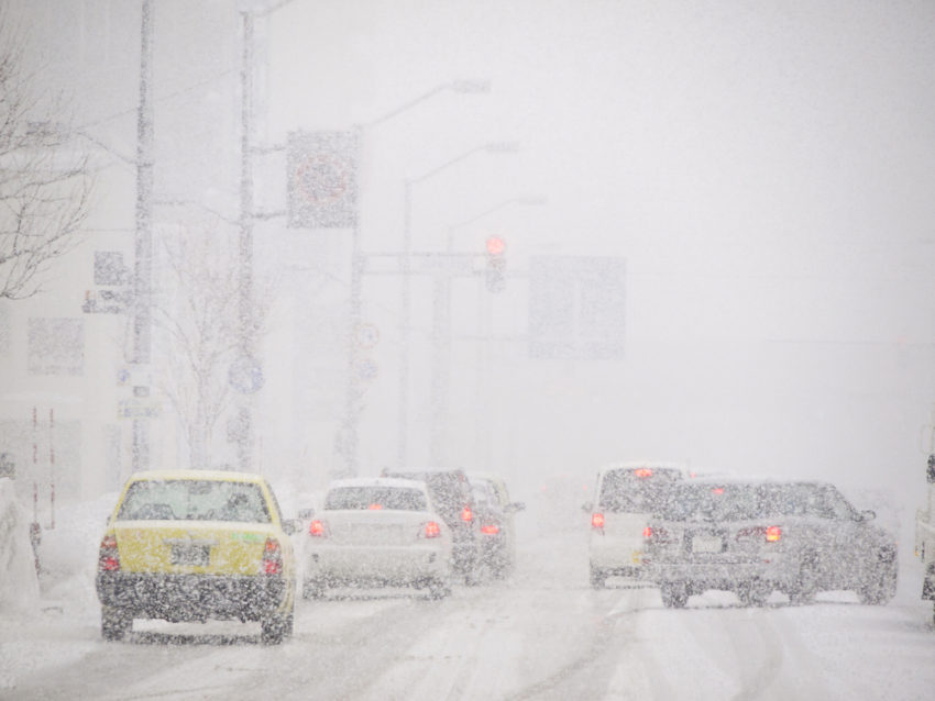
Blizzard like conditions have lead to whiteout conditions or low visibility in several areas of Minnesota and South Dakota. Travelers in this region are urged to use extreme caution as snow covered roads and reduced visibility lead to dangerous driving conditions.
Rain Threat:
On the warm side of the storm, showers and thunderstorms will push east Friday into early Saturday from portions of the Gulf Coast all the way up into Wisconsin. Behind many of these storms will come much cooler temperatures compared to previous days.
The Morecast team will be monitoring the winter storm and will send updates across Twitter and Facebook as needed. Use the Morecast app to receive forecast details specific to your city and travel destinations!