The first signs of the coming winter storm have appeared as snow begins to fall in Wyoming. A significant winter storm will roll through the north-central Plains this Friday. A potent system will swing out from the West by Thursday. This disturbance will spin up a strong low pressure tracking through the northern Plains bringing a large area of snow and wind for the end of the week.
Snow Threat:
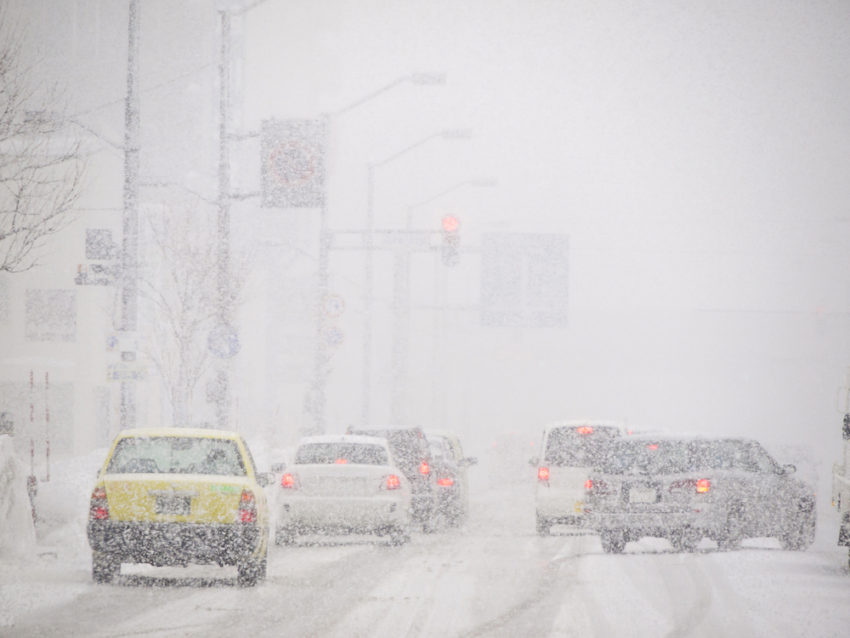
With many ski resorts in the Rockies preparing to open over the coming weeks, prospects for colder air and heavy snow are welcomed by resort managers and skiers alike. However, high winds and heavy snows will pose significant travel concerns for many others. As the snow and wind spread east, dangerous blizzard conditions will threaten parts of the Plains into the Upper Midwest Friday into Saturday.
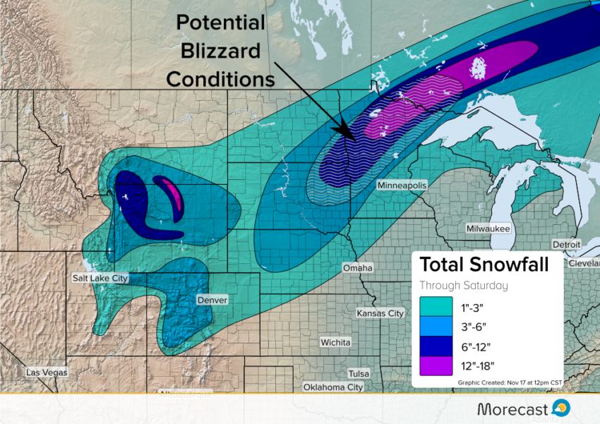
Light snow will affect a broad region of the Northern Plains and Upper Midwest. 1-3 inches are likely from Nebraska through northern Michigan. Heavy snow is likely in the mountains of Wyoming Thursday into Friday. 6-12 inches can be expected around Yellowstone with over a foot possible in the Big Horn Mountains.
Further east, heavy snow will fall near the low pressure center. As the low intensifies in the Upper Midwest, a band of heavy snowfall will develop. The heaviest bands will potentially drop over a foot in some locations from Thursday into Saturday. Another hazard with this rapidly developing low will be very strong winds. These winds may bring blizzard conditions from South Dakota through northern Minnesota beginning late Thursday into Friday evening. The National Weather Service has issued a blizzard warning for northeast South Dakota and western Minnesota.
High Wind Threat:
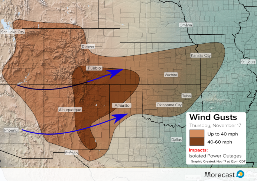
Strong west to southwest winds accompanying this disturbance will extend far from the low pressure center. A large area from Utah to Missouri will see the potential for wind gusts reaching 40 mph Thursday. Additionally, wind gusts up to 60 mph are possible across the southern High Plains. This includes areas from the Sangre de Christo Mountains to the Oklahoma and Texas Panhandles. Isolated power outages are possible, particularly where winds exceed 40 mph.
Rain Threat:
On the warm side of the storm, there is the potential for showers and thunderstorms Friday into early Saturday from portions of the Gulf Coast up into the Mid Mississippi Valley and parts of the Southern Plains.
A slight change in the track of this system may occur in the coming days and placement of the heaviest snow band may still vary slightly. The Morecast team will be monitoring and send updates across Twitter and Facebook as needed. Use the Morecast app to get forecast details specific to your city and travel destinations!