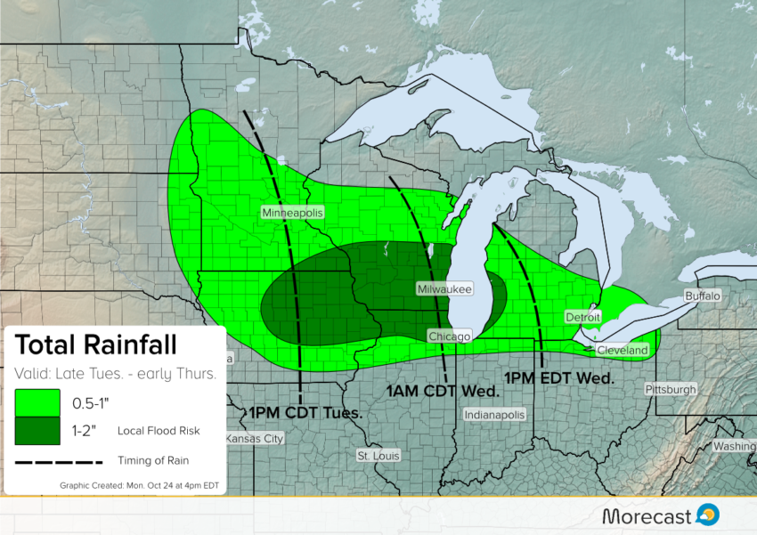
A storm system will develop and bring unsettled weather to the Midwest and Great Lakes. How much rain can you expect for your area?
An area of low pressure will develop over the central Plains and move into the southern Great Lakes by Wednesday.
Rain is expected to develop across the Midwest late Tuesday and push into the Great Lakes during the day Wednesday. Although overall rainfall totals will not be substantial, some areas could see up to 2 inches by the time all is set and done from Cedar Rapids, Iowa to Milwaukee, Wisconsin. Temperatures will remain on the cool side because of high pressure to the north.
Further south of the system, some isolated thunderstorms are possible from southern Iowa down through Oklahoma. A Few storms may be severe. Further north of the system, moisture will encounter some much colder air which may aid in the chance for some to see wet snowflakes mix in with rain.
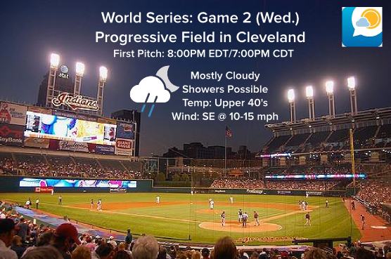
For baseball fans, World Series Game 2 in Cleveland could be impacted by rain Wednesday night.

After early Thursday, the unsettled weather will move east into the Mid-Atlantic states to conclude the work week.
For up to the hour forecasts and updates on the weather, be sure to follow Morecast on Facebook and Twitter.
Feel free to download the Morecast weather app and upload your weather related pictures to the community tab!
