Cool fall temperatures and mountain snow will return to the Northeast this weekend, providing some joy and optimism for winter sports enthusiasts.
An area of low pressure off the coast of New England will move north into the Canadian Maritime on Saturday. As it does so, a shot of colder air will move in from the northwest. Over the mountains, the colder air will mix down and cause a changeover from rain to wet snow. Snow levels will start off around 5,000 feet through Saturday afternoon, before dropping down to 3,000 feet by Sunday.
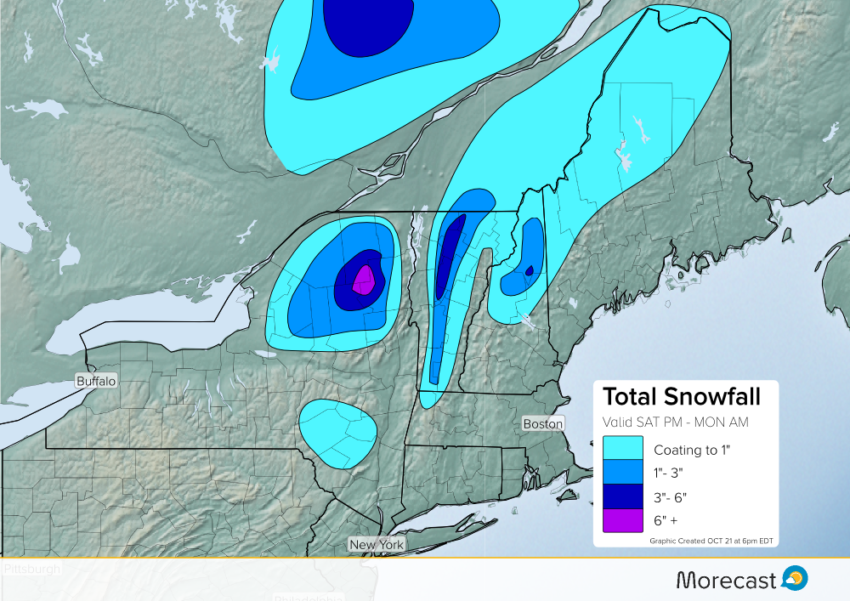
Since early week temperatures were well above average, grounds are warm and thus snow accumulations will be confined to grassy, tree, and dirt surfaces. However, some higher elevated roads over the Adirondack, Green, and White Mountains may experience some slush during persistent, heavier bouts of snowfall. Additionally, gusty winds could lead to scattered power outages as wet foliage weighs down branches and power lines.
Stay up to date with MORECAST and Follow us on Twitter and Facebook!