Fall will work its way back into the East as we head into the weekend. Chillier, wet weather is in store for the region, along with some New England mountain snow.
Hot, Hot, Hot!
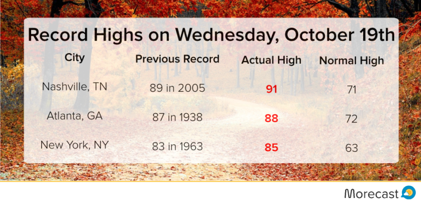
Abnormally warm temperatures have set numerous records across the eastern U.S. this week. New high temperature records were set Wednesday in New York City, Atlanta, and Nashville, to name a few.
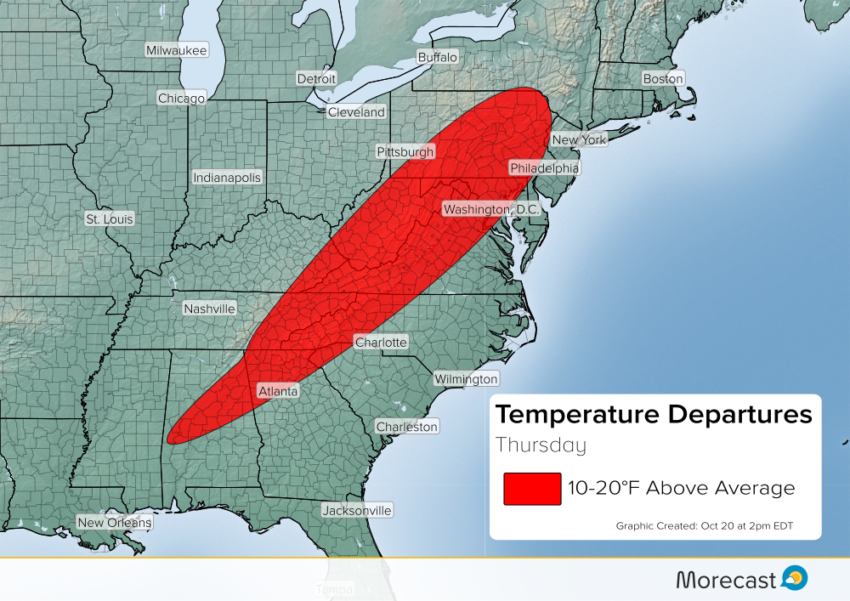
Thursday will bring more above average temperatures to interior portions of the Southeast and Mid-Atlantic region, ahead of a cold front currently draped through the Ohio Valley and Lower Mississippi Valley region.
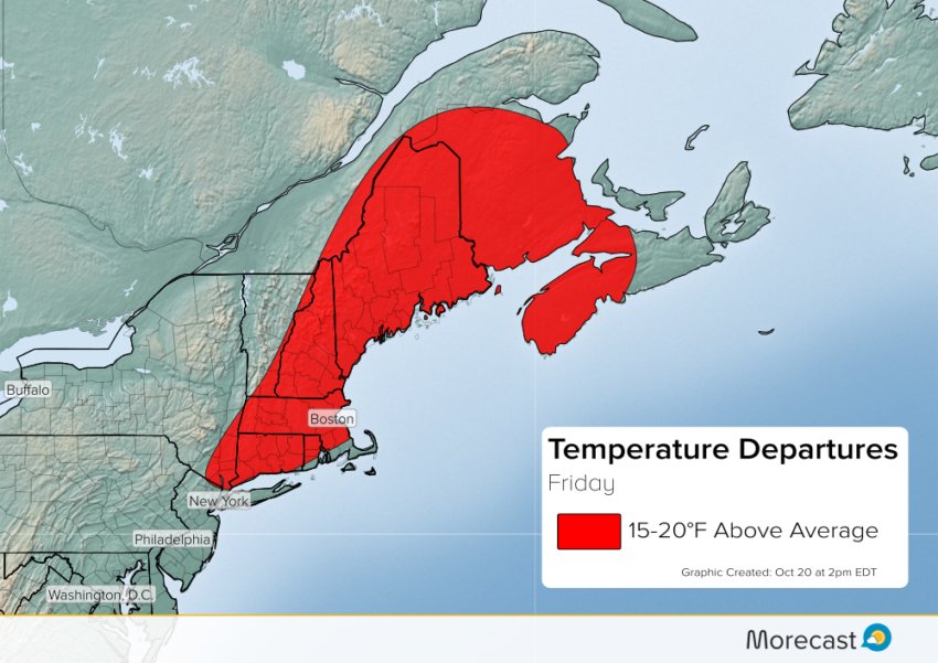
As this front pushes eastward into Friday, the above average temperatures ahead of it will also push eastward. Look for above average temperatures into New England on Friday.
Front Brings Back Fall:
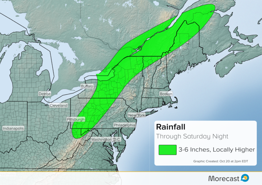
As this cold front pushes eastward through Saturday, many locations that have seen unseasonable hot temperatures this week will be doused in rain with cooler temperatures following. The front will stall out east of the Great Lakes and combine with Atlantic moisture streaming northward into the region to produce abundant rainfall. Locations through the eastern Great Lakes region, the northern Appalachians, northern New England, and the adjacent St. Lawrence River Valley of far eastern Ontario and southern Quebec will see several inches of rain through Saturday night. Look for the hardest hit regions to see 3-6 inches of rain with locally higher amounts likely.
On Saturday, colder air will wrap around behind the system, dropping snow levels to 3,000 feet in northern New England. Minor to moderate snow accumulations will occur in the mountains.