A summer like air mass has settled into the upper Midwest pushing high temperatures 15-25 degrees above average for Monday. This unseasonably warm air mass is also going to bring the chance for severe weather by the late afternoon.
Severe Risk Details:
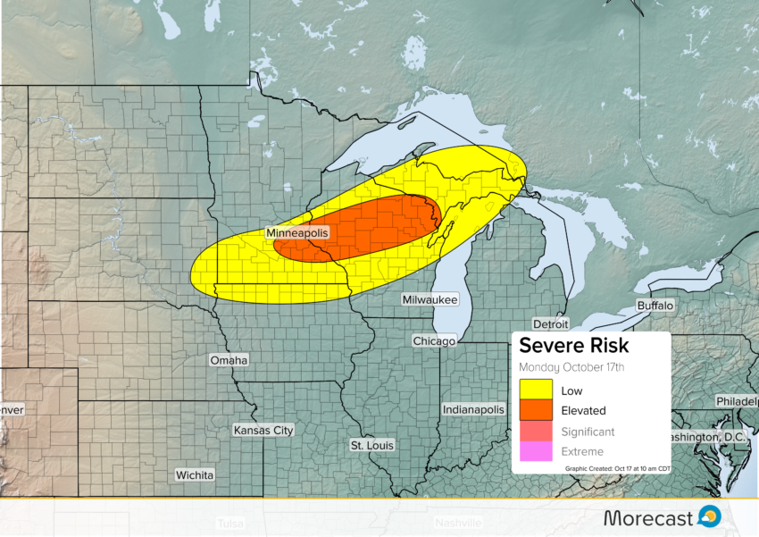
A warm front set up over southern Minnesota stretching east into central Wisconsin will kick off t-storms during the late afternoon and evening. The greatest risk for severe weather will be from the Twin Cities east to the north of Green Bay. Strong storms in this area will be capable of strong winds, hail and isolated tornadoes.
The risk for severe storms is less over southern Minnesota and the upper peninsula of Michigan but a few isolated storms could produce strong winds and hail.
A cold front will push through the Midwest on Tuesday and that will bring the return of a fall like air mass for the end of the week.