The Pacific Northwest has been blasted with a series of storms producing strong damaging winds and flooding rains. One last storm system will move through the region Saturday afternoon through Sunday.
The first two storms and associated cold fronts swept through the region last Thursday-Thursday night and late Friday-early Saturday, producing widespread high winds upwards of 100 mph, flooding rains up to 4-6 inches in spots, and even a few isolated tornadoes:
A look at the coastal tornado from viewer Julee Ward. #LiveOnK2 pic.twitter.com/wzQQFquhyU
— KATU News (@KATUNews) October 14, 2016
Update: The National Weather Service in Portland, Oregon conducted a storm survey of a tornado and concluded that an EF2 tornado with winds in excess of 110 mph struck the coastal town of Manzanita .
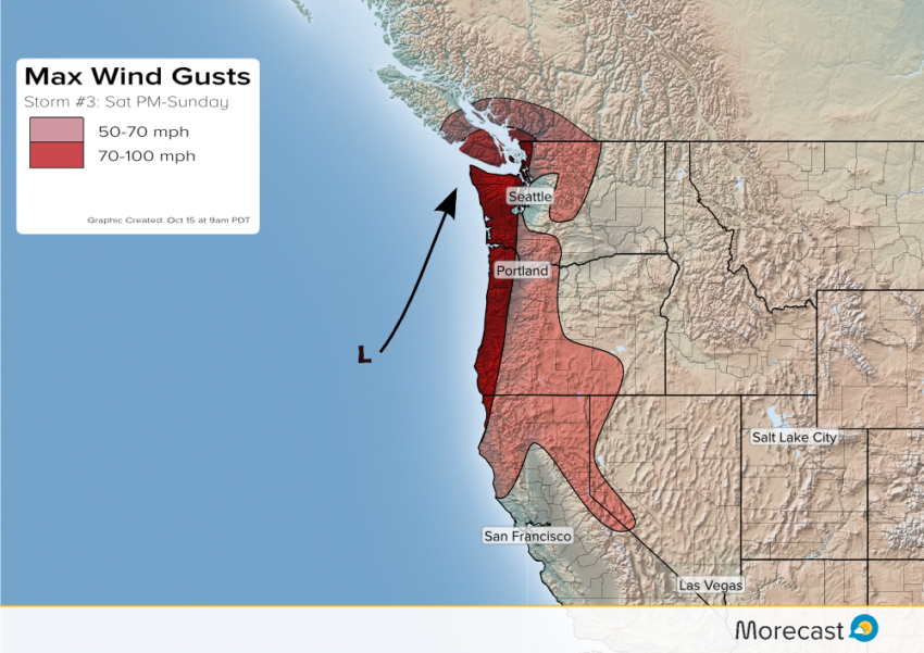
Storm Three:
After a relative break in the action on Saturday morning, winds and rains will increase again later in the afternoon, persisting through much of Sunday. This third storm will be stronger with widespread winds of 50-70 mph (see above right). Gusts of 70-100 mph can be expected in wind prone areas near the coast and in the higher terrain.
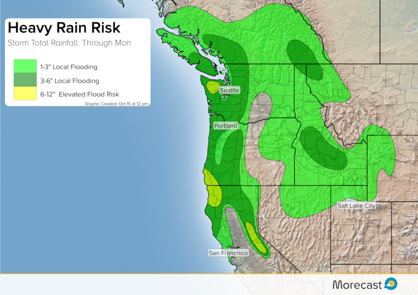
Rainfall & Flooding:
Periods of heavy rainfall will also continue through early Monday. The highest additional amounts of 6-12 inches are likely in the Sierras and from northwest California into southwest Oregon with significant flooding and mudslides likely. Amounts of 3-6 inches will be common elsewhere on top of what’s already fallen.
The combination of heavy rain and high winds will lead to power outages in many areas, some lasting for several days. We’ll keep monitoring the situation and issue updates accordingly. Follow us on Twitter and Facebook for the latest information.