A winter-like set of storm systems are barreling across the Pacific on a collision course with the Pacific Northwest. This carousel of storms will bring torrential rain to a wide swath from California to British Columbia.
There will be a pair of storms rolling through the West Coast from today to Monday. The first storm will be interrupted by a lull in activity Friday night and Saturday morning before the next storm blasts through Saturday night. Both will bring intense rainfall and strong winds, especially along the mountain ranges from the Sierra through the Cascades. Here’s a breakdown on what each event will bring.
Event 1: Thursday – Friday
The Pacific Northwest has already begun to see strong wind gusts this Thursday afternoon, although the strongest winds will begin later this evening. The first event will be triggered by a low stalling just off the coast. As the low closes in, it will bring a moist, tropically rooted airmass. This bout of rain and wind will focus more on the north, though heavy rain will fall in California too. Showers will begin in Washington early Thursday morning, increasing in coverage and intensity as the day goes on. With an approaching cold front Thursday night, periods of very heavy rain and high winds will roll down the Oregon and California coasts. A few regions will see rain of half a foot which will bring a danger of flash flooding and mudslides.
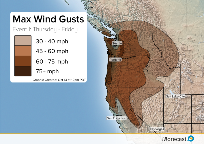
Damaging winds will be seen along the Coastal Range of Oregon as well as the Cascades in interior Washington. High winds and heavy rain will batter the region for most of Thursday night before easing into more isolated showers Friday.
Event 2: Saturday – Monday
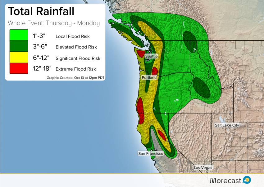
Typhoon Songda in the western Pacific will turn toward the east and rocket into the West Coast late Saturday bringing the next batch of intense rain and strong winds. This round is forecast to be much stronger than the first event. The second storm favors the south a bit more, bringing periods of very heavy rain from the southern Oregon coast into the Sierras. Again, this deluge will bring threats for flash floods and mudslides as the rain piles up. The most prone regions will be in northern California and southern Oregon. Rainfall totals from Thursday to Monday could reach up to 18″ in some regions, especially in the Sierras, northern California and southern Oregon.
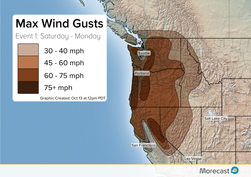
Intense winds will extend further south this time as well. Elevated regions of central Oregon and the northern Sierra Nevada will see gusts near hurricane-force. Forecast models still show some disagreement on the exact track of the storm on Saturday. Depending on the track, a major wind event could occur for the western portions of Washington and portions of Oregon.
The combination of prolonged damaging winds and heavy rain will bring dangerous conditions to the Northwest through this weekend. High winds may lead to power outages and downed trees while heavy rain will likely cause flash flooding and mudslides. Additionally coastal flooding will threaten the region as high waves batter the shoreline for days on end. Finally snow will fall in the higher peaks, but will remain above pass height.
Morecast meteorologists are closely monitoring the parade of activity inbound to the West and will keep you up to date as details develop.Be sure to follow along with us on our Facebook and Twitter pages. Also share pictures you take of the wind, rain, and any damage that may occur to the community section of the Morecast app.