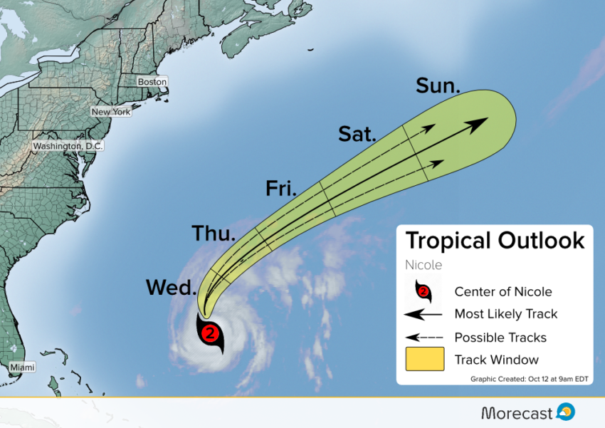
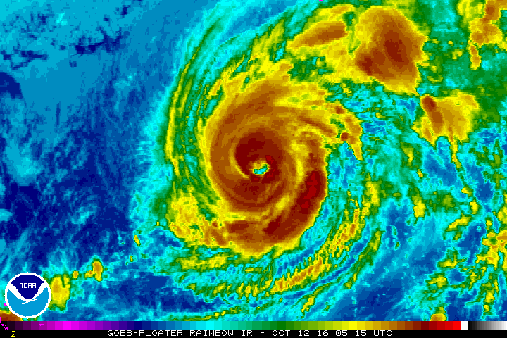
Hurricane Nicole continues to crank up winds over the Atlantic. After meandering around the open sea for several days Nicole is starting to move north, with Bermuda in its path. Following a long stretch as a tropical storm, Nicole has intensified into a strong Category 2 hurricane and will bring battering winds to the British Territory.
Since Matthew has moved out of the picture, the unfavorable conditions it was bringing to Nicole have eased. The cyclone has been strengthening and drifting north for the last couple days (see satellite animation below). It will speed up and make a turn to a more northeasterly direction later today. This shift will put Bermuda in the crosshair Thursday. The storm will pass within miles of the small island, potentially becoming only the third hurricane in 100 years to make landfall as a Category 2 or greater.
EXPECTED IMPACTS:
Nicole should be a Category Two hurricane as it nears Bermuda. Its closest approach expected to occur near midday Thursday. Tourists and residents there should begin preparations now for:
- Destructive winds exceeding 100 mph (160 km/h) with gusts to 120 mph (190 km/h)
- High surf and storm surge flooding, especially on the south and east sides of the island
- Torrential rainfall and isolated tropical tornadoes
Nicole will move quickly away from Bermuda Thursday night with conditions rapidly improving. We’ll keep sending updates as long as Nicole threatens Bermuda – follow us on Twitter and Facebook.