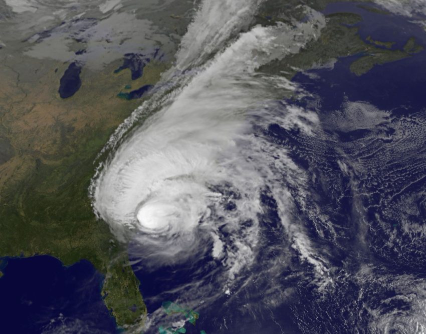
As of Saturday afternoon, Hurricane Matthew was barely maintaining hurricane strength, with peak sustained winds around 75 mph, just one mile per hour above the threshold needed for a storm to be considered a hurricane. But even if Matthew’s strongest winds are in the past, that doesn’t mean the threat for North and South Carolina is over, as heavy rain, gusty winds, high surf and isolated tornadoes are still all possible for the remainder of Saturday night. Virginia and southeast Maryland are also facing the threat for flash flooding.
As of Saturday afternoon, Georgia and the Carolinas were already fully drenched from relentless rains. Almost everyone from Savannah up to Wilmington recorded at least seven inches of rain, with the majority of rain gauges recording 10 inches or more, including in Charleston. Even though Matthew is likely to drop below hurricane strength later Saturday, winds will remain strong between 30 to 60 m.p.h. across eastern portions of the Carolinas, still strong enough to knock down trees and blow around lose debris.
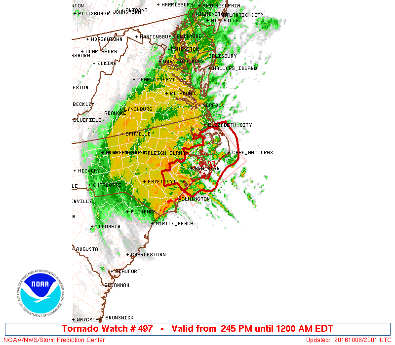
Combined with the gusty winds will be several more inches of rain, with an additional three to eight inches expected in eastern North Carolina, eastern Virginia, and the Delmarva Peninsula in southern Maryland. With widespread flooding anticipated, it is inadvisable for people to be out, especially on the roads at any point Saturday night or Sunday morning. If that’s not enough, a Tornado Watch is also in effect for eastern parts of North Carolina until midnight due to the threat for brief spin ups.
LOOKING AHEAD
There are indications frontogenesis is occurring within the storm, simply meaning that temperature fronts are starting to form, which indicates Matthew is transitioning from a tropical system to more of a standard low pressure storm. While there may be some debate in the meteorology community about when Matthew will no longer be a tropical system, the fact is that it will remain an impactful storm Sunday evening, when it finally drifts far enough east to bring an end to the rain and winds for North Carolina and Virginia.
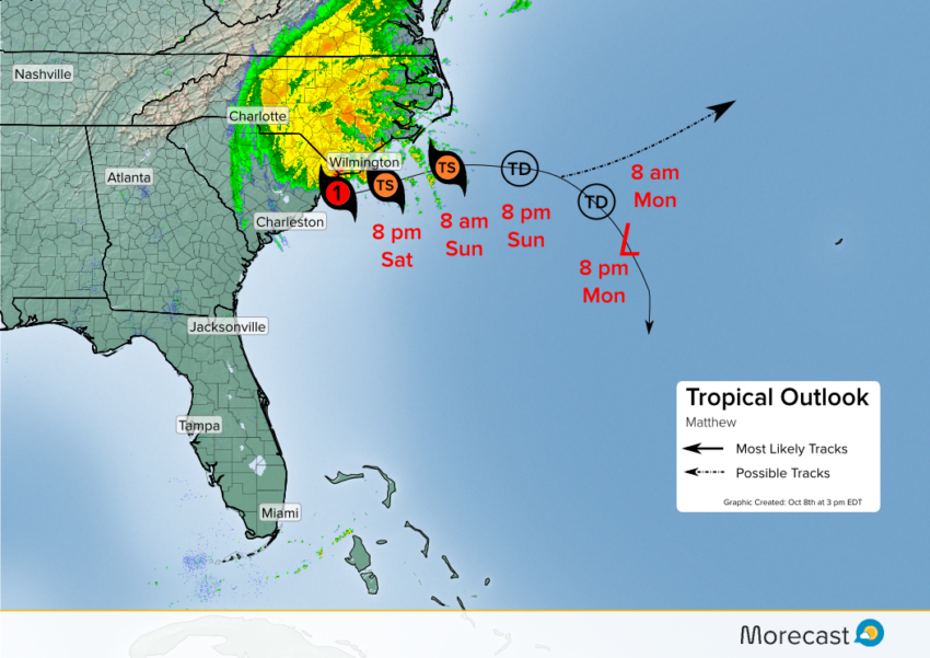
There’s still some question on which direction the remnants of Matthew will take once out in the ocean, with models just about evenly split between a northeast track versus a southern track. Regardless of which track it takes, Matthew is expected to continue weakening down to a tropical storm before becoming extratropical (losing its name) by Monday evening. And those in the Bahamas can take a deep breath too. While early indications had the storm dropping south, strengthening and slamming back into the island nations, that no longer appears likely. Should the remnants even reach the Bahamas later next week, it would just bring a little bit of rain.