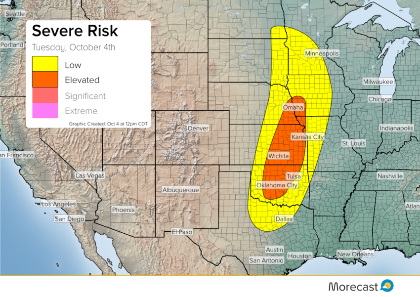
A cold front with a mid-level trough is moving through the High Plains this afternoon into evening. Instability is not as strong as one would like across the northern portion but there is still potential for some severe storms to trigger along that area.
The ‘elevated’ area has a different plan for storm potential. Moderate instability and moisture builds as the day progresses while a shortwave moves across the area. A low level jet increases the chances for supercell development. These storms could see large hail up to 2 inches, strong winds up to 70 mph and isolated tornadoes. The greatest tornado potential is the boarder of Oklahoma and Kansas where the greatest low level shear is.
Right now there are a few thunderstorms that are moving across Nebraska, Iowa and South Dakota due to warm advection. The stronger storms are expected to fire late this afternoon into evening where Kansas will start to see storms develop over the next 1 to 2 hours (1-2 pm CDT). As the sun goes down storms will start to dissipate due to lack of diurnal heating but the low level jet will keep some severe storms moving into the night.