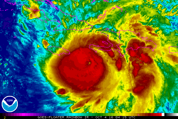
Hurricane Matthew is a category four cyclone packing winds of 145 mph. It’s on course to devastate the Greater Antilles and the Bahamas in the next few days. What kind of threat will Matthew pose to the US mainland? The Morecast team offers a couple of different possibilities as we wish the best for our friends to the south.
Tuesday October 4th – 11:30 am (EDT)
Matthew remains a very dangerous hurricane, on track for Cuba after landfalling over Haiti. By mid-week, Matthew will be roaring through the Bahamas. Warm water and supportive upper level winds should allow Matthew to remain a powerful hurricane despite the influence of the landmasses in the Greater Antilles.
Two features thousands of miles apart will guide the movement of Matthew storm through next week. One feature to watch is a very strong ridge of high pressure over the Atlantic. Another is a cold front currently sweeping through the Dakotas.
Some possibilities suggest the storm will make it to the Southeast US coast before turning to the northeast. Other models show the turn occurring more quickly, allowing Matthew to track further off the coast.
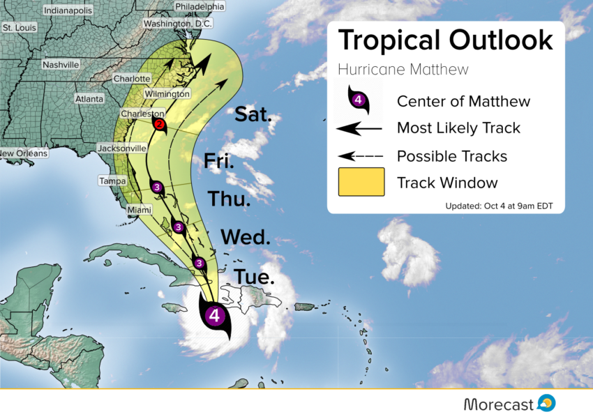
Scenario One:
Scenario one assumes the high pressure in the Atlantic will remain as strong as it has been in recent days, which will allow the storm to push west, feeling the effects of a cold front pushing across the US. With latest model data, this scenario appears more likely. This track would push Matthew very close to, or even onto the Southeast coast, bringing hurricane or tropical storm conditions to Florida and the Carolinas.
Major impacts to the US mainland, especially the Outer Banks of North Carolina:
- Destructive winds
- Moderate storm surge
- Torrential coastal rains
Scenario Two:
Scenario two assumes an eastward movement of the Atlantic high pressure. As this moves east, it would carve a path for Matthew to turn to sea after tracking through the Bahamas. This track would keep the storm further to sea and minimize the effects felt in the USA.
Minor impacts to the US mainland:
- Breezy conditions, especially on the beach
- Intense rainfall
- High surf/rip currents. Caution advised for swimmers and small watercraft.
Model guidance wants to weaken the high pressure and move it east. They have been trying to do this for days however, and the ridge has proved resilient, meaning it may not play nicely with what forecast guidance suggests. At this time neither scenario can be ruled out, and we will know more once Matthew clears Haiti and Cuba.
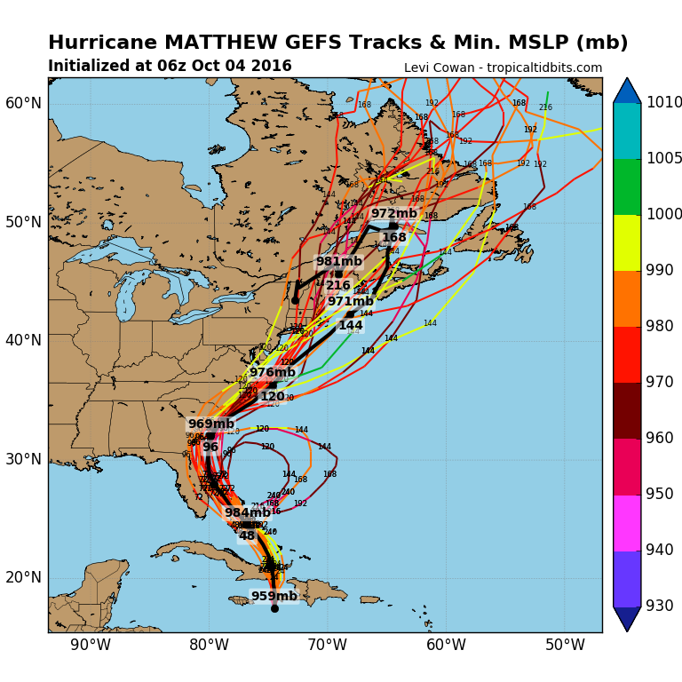
Regardless, strong winds will extend far from the center of Matthew, so even if the storm stays well to the east, tropical storm conditions will still be possible in Florida and possibly North Carolina later this week.
Additionally any system of Matthew’s intensity skirting the Southeast coast could threaten the Northeast or parts of Maritime Canada. We’ll keep watching closely and issue frequent updates as the latest information becomes available.