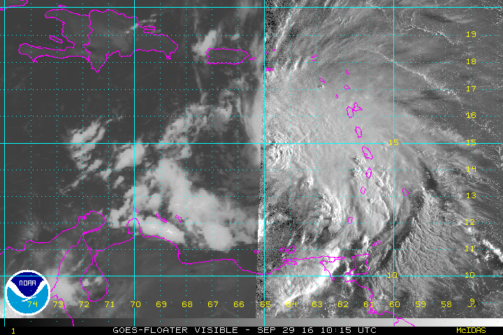
The latest aircraft recon and satellite data indicate that Matthew has become a minimal hurricane with sustained winds to 75 mph. Conditions are expected to become even more favorable for intensification on Friday or Saturday. Matthew could threaten Jamaica and Cuba by Sunday or Monday!
Strong shear had exposed the center of circulation on Thursday morning with storms displaced to the northeast. However, a strong cluster of storms has recently fired around the center. Data from the NOAA recon flight also indicates Matthew has strengthened. Shear is expected to gradually relax, especially Friday into Saturday. Meanwhile, Matthew is moving over very warm ocean waters, perfect fuel for rapid strengthening if the shear improves.
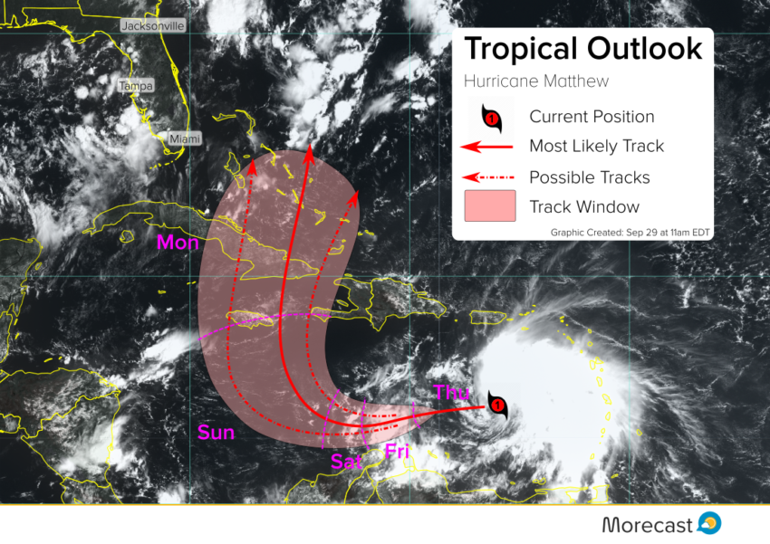
TRACK FORECAST:
Matthew will continue to move west over the next few days, perhaps losing some forward speed. By Sunday into Monday Matthew will turn to the northwest and north, threatening Jamaica and Cuba. High winds, large surf and storm surge, and flooding rainfall would accompany any landfall. After that Matthew could move across portions of the Bahamas and into the Atlantic just off the Southeast US coast. Much uncertainty exists in this extended portion of the forecast, however significant impacts along the Eastern Seaboard can’t be ruled out.
Stay tuned for more updates from the forecasting team at Morecast on Twitter and Facebook!