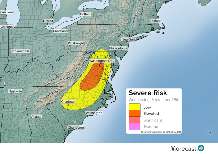
A cut off low pressure system centered over the Ohio Valley will bring an active day across parts of the eastern U.S., with severe storms possible in the D.C. metro area, Virginia and North Carolina. Storms will develop during the early afternoon and continue into the evening hours.
The Beltway is included in the threat and is close to where the strongest storms are expected Wednesday. Severe storms that develop will be capable of strong wind gusts, hail and even brief tornadoes. The best chance for stronger storms will be to the south of D.C. along the I-95 corridor, including Richmond. But even if the strongest storms miss Washington, a slow evening commute is still likely with heavy rain expected around the Capital, continuing into Wednesday night and still impacting the Thursday morning rush as well. Localized flash flooding is a concern, with strong storms producing up to two inches of rain in a short period of time. The cut off low will continue to bring flash flooding problems to the region for Thursday and Friday.
The threat for strong storms will become more isolated as you move into North Carolina, but storms will still pose a wind threat to the Research Triangle and Charlotte areas.
To stay up to date with the latest weather follow us on Twitter and Facebook.