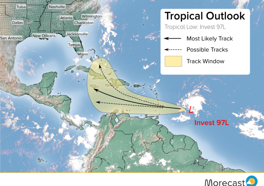
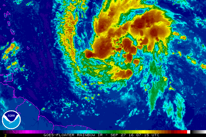
The Morecast team is watching a tropical system over the open Atlantic, currently gaining strength in an area of warm ocean waters and low shear. This system has a strong potential to become a tropical cyclone as it moves west over the next few days, aiming for the Windward Islands or possibly even the northern coast of South America.
It is quite rare to see a tropical storm threaten South America. The last tropical storm to make a direct landfall on mainland South America was Tropical Storm Bret in 1993. As of now we’re expecting this disturbance, known as Invest 97L, to stay just north and impact the Windward Islands.
However, some of the models suggest it could take a more southerly track. This would put major cities along the coast of Venezuela like the capital, Caracas, at risk for high winds and torrential, flooding rainfall for the mid to late week period.
LONG-RANGE FORECAST:
The cyclone is expected to approach the central Caribbean by the weekend. If this pans out, it could be picked up by atmospheric currents in the mid-latitudes and dragged northwest or north.
Much uncertainty exists with the track forecast beyond the end of the week. We’ll monitor this system closely and issue updates accordingly.
Follow us on Twitter and Facebook for the latest updates! Our app also has the latest forecast details for locations across the globe.