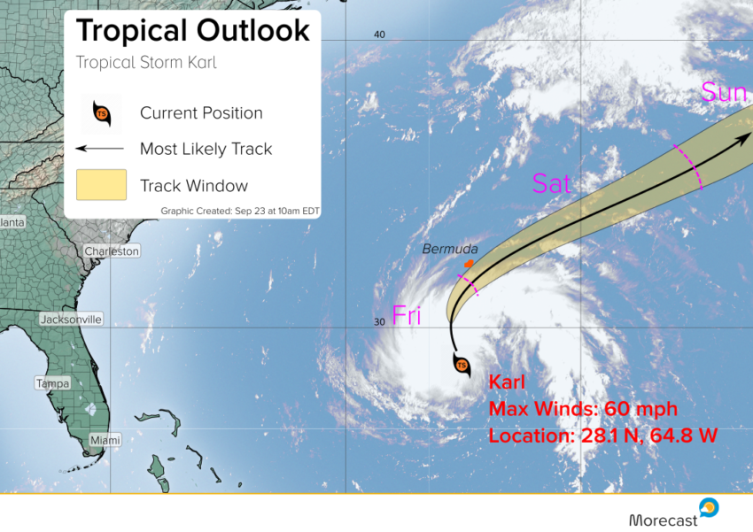
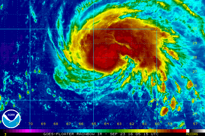
Newly rejuvenated Tropical Storm Karl is looking better and better on satellite imagery this Friday morning as it makes a beeline for Bermuda. There’s the potential for it to be a hurricane later Friday as it nears the isolated island. What kind of impacts can residents and tourists expect?
Karl was upgraded to tropical storm again last night and continues to show signs of intensification this morning as it encounters warmer ocean waters to feed on. Maximum sustained winds are up to 60 mph, not far from the hurricane threshold of 74 mph. There’s a chance it could reach that status before or as it passes close to Bermuda.
FORECAST:
Karl is moving north-northwest but is expected to turn to the northeast as a front approaches from the U.S. East Coast. How fast it turns will determine how bad conditions get on Bermuda. Residents and tourists should be prepared for very strong winds, high surf and tides (especially on the south and east sides of the island), and torrential rain. Conditions will deteriorate rapidly later Friday afternoon with the worst squalls early Saturday morning. By Saturday afternoon, the storm should be winding down.
You can find forecast details for the capital city of Hamilton or the outlying towns using the Morecast app! We’ll also issue updates as needed on Twitter and Facebook.