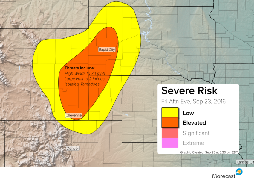
Widely scattered severe storms are expected to develop after 5 pm ET (3 pm MT) from eastern Wyoming into western portions of Nebraska and South Dakota. Major cities like Cheyenne, WY and Rapid City, SD are at risk of seeing severe storms through Friday evening.
Instability is increasing over this area thanks to daytime heating. Meanwhile, a potent upper level system is approaching, setting the stage for severe storms to erupt. Dangerous high winds to 70 mph, large hail to 2 inches in diameter, and isolated tornadoes will all be possible with the stronger supercells. The severe threat should wane after midnight ET (10 pm MT).
For all the latest forecast updates, keep an eye on our Twitter and Facebook feeds. Upload pictures of those gorgeous Plains supercells, if you can do so safely!