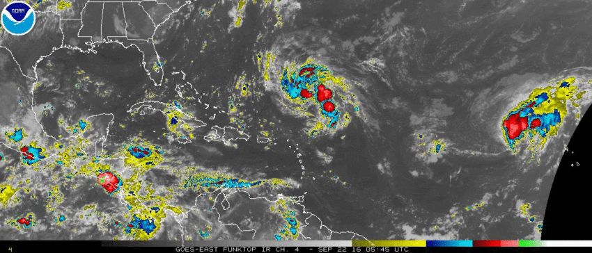
We spend a lot of time talking about a “hostile” environment preventing tropical cyclones from intensifying. That’s the situation confronting Tropical Depression Karl and Tropical Storm Lisa over the open Atlantic now. But what makes the conditions so unfriendly?
Tropical cyclones like Karl and Lisa feed on warm ocean waters and need relatively light winds aloft to become more organized and intensify. We’re right in the peak window for tropical storm activity over the Atlantic Basin. Generally speaking there’s no better time of year for hurricanes to flourish. But Karl has been downgraded after attaining tropical storm status earlier this week, and Lisa is forecast to weaken while it moves slowly north.
The two images below give us a clue as to why Karl (left) and Lisa (right) are struggling. The first graphic shows anomalies in vertical wind shear, the change in wind speed and direction as you climb up through the atmosphere. The higher the shear, the less a cyclone is able to wrap strong storms around its center of circulation. The second image depicts sea surface temperature anomalies. Warmer water means more energy available for cyclone strengthening.
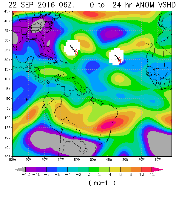
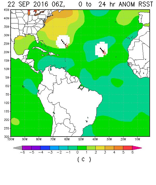
Karl and Lisa are both moving towards regions of high vertical wind shear (yellows and oranges in top image). Lisa also faces unusually cool ocean waters (teal in bottom image) on its current path. However, Karl may encounter warmer waters (yellow) that could allow for some restrengthening despite the wind shear. Karl’s forecast path may also carry it dangerously close to the island of Bermuda in the next few days. Residents and tourists will need to keep a close eye on Karl as it moves nearby.
Keep following us on Twitter and Facebook to get the latest updates on the tropics!