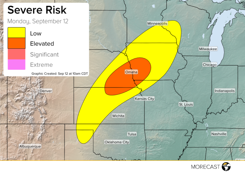
A cold front draped through the Northern Plains is bringing signs of fall to the Dakotas and northern Rockies. This same front will bring a severe threat from Oklahoma to Minnesota to start the work week.
Fall-like morning temperatures in the Dakotas are colliding a with warmer, more humid air across Nebraska and Iowa. As this cold front pushes further southeast this afternoon, it will tap into this more unstable air bringing the potential for severe storms. With these storms, many communities from Oklahoma to Wisconsin will see the risk for large hail and strong winds. Severe ingredients best come together in eastern Nebraska and Iowa, which we have highlighted as having an elevated risk for severe weather.
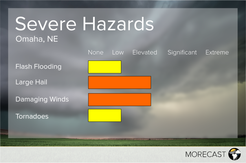
Storms should be approaching Lincoln, NE near the end of the evening rush hour before moving on to Omaha. As the graphic above shows, storms will bring strong winds and large hail. An isolated tornado will also be possible in the most intense storms. Additionally, with the amount of Gulf moisture in place heavy rain will likely be seen in these storms.
Be sure to keep up to date with these storms as you head home from work this afternoon. You can use the MORECAST app for radar and lightning information to keep you ahead of the storms. Also be sure to follow along with the MORECAST team on our Twitter and Facebook pages as we bring you the latest breaking weather news.