Tropical Storm Hermine has dumped between 5 and 8 inches of rain from Pensacola to Tampa, Florida, northward through adjacent southern Georgia. Heavy rain and flooding will continue to be the main threat, but some gusty winds and a few tornadoes are possible as well!
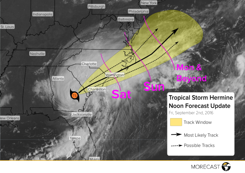
Hermine is holding her own as she sits over land. Current winds around Hermine’s center are gusting between 40 and 50 mph and heavy rain continues to fall. Through the remainder of today and early Saturday, Hermine will traverse the Southeast while likely keeping her tropical storm status, reemerging over open waters by Sunday. Once offshore, she’ll follow the warm Gulf Stream and reside off the Mid-Atlantic Coast. Models diverge once she arrives at this stage, but MORECAST meteorologists will closely track Hermine as she could threaten coastal New England! Tropical Storm Warnings are posted through the DelMarVa region, with Tropical Storm Watches northward into Connecticut.
Heavy Rain and Flooding:
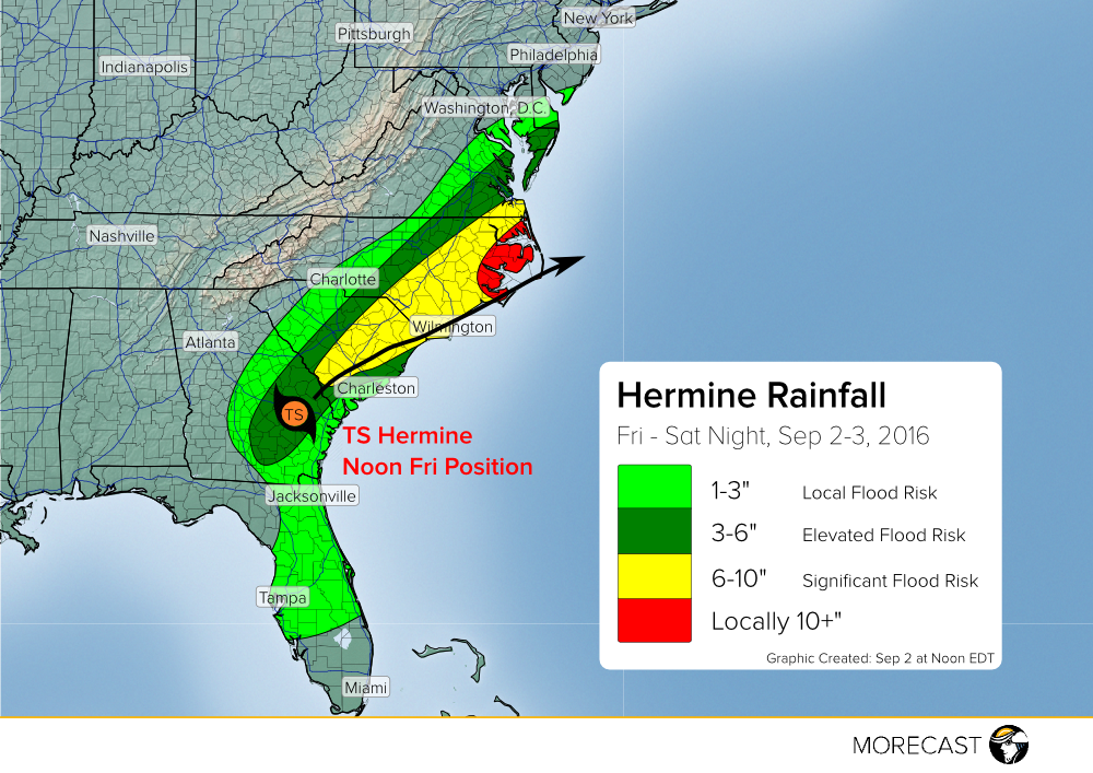
Hermine has already dumped between 5 and 8 inches of rain to portions of northern Florida and southern Georgia. Look for a heavy swath of rain to continue during the first part of the holiday weekend through southeastern Georgia, and central and eastern portions of the Carolinas. Many places will see at least 6 inches of rain, and localized areas could see over a foot of rainfall! Rising rivers and creeks are likely, so watch out for flash flooding. Elevated surf and rip currents will make swimming extremely dangerous, so take caution on the beach this Labor Day weekend! (NOTE: Rainfall amounts depicted below are additional amounts through Saturday night.)

High Winds/Isolated Tornadoes:
High wind gusts of 40-50 mph will be common inland near the storm’s center, with exposed beaches seeing gusts to 60 mph. High winds combining with the heavy rainfall will cause widespread power outages due to fallen branches and trees. Minor damage will be possible and power outages could last for several days.

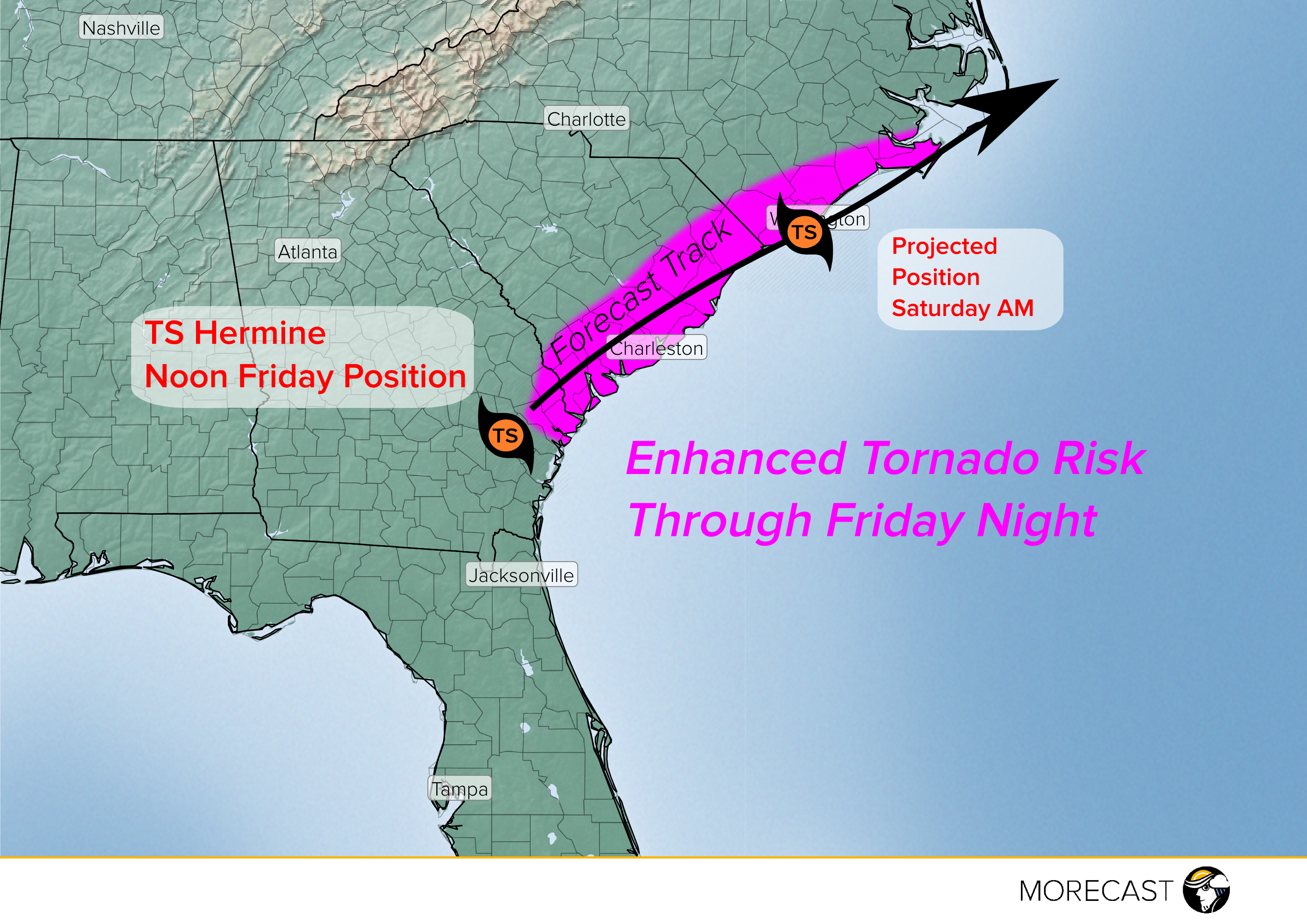
Isolated tornadoes will also occur near, and east of, Hermine’s center, especially across coastal locations. Watch for this enhanced threat area from far southeast Georgia, northeastward through southern North Carolina. These tornadoes tend to be relatively weak and short-lived, but fast-moving and difficult to track, enhancing the danger they pose to unwary residents in the at-risk areas.
Please pay close attention to emergency broadcasts in the Southeast over the next few days and heed calls for evacuation if they come! We’ll continue to issue frequent updates via our Twitter and Facebook pages.
