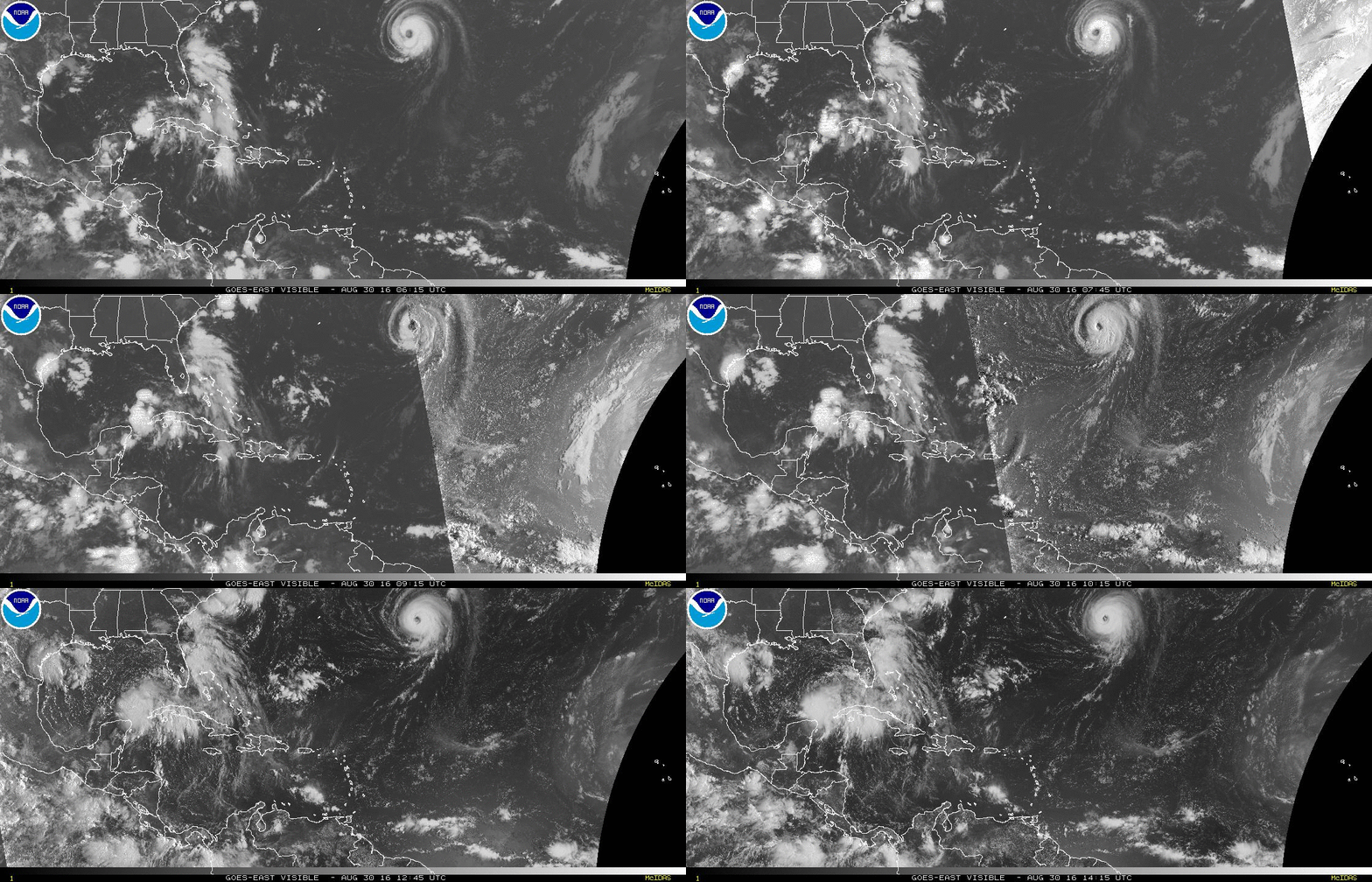
Hurricane Gaston has waved goodbye to North America, and has turned toward Europe. We’re still dealing with two tropical depressions in the states though, with one likely to become Tropical Storm Hermine Tuesday.
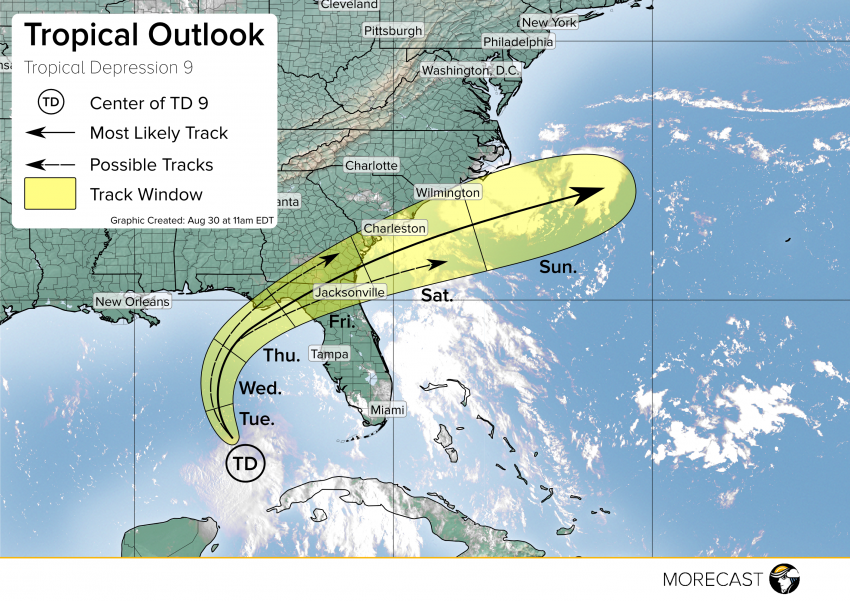
The two tropical depressions threatening the US coast have very different outlooks. Tropical Depression 8 located just off the North Carolina coast is extremely disorganized. This storm is beginning its turn back to sea and its effects will be few and diminishing. Tropical Depression 8 however, seen near Cuba, is beginning to show stacked convection around the center and is likely to become Tropical Storm Hermine later today.
This storm will begin turning toward the north this afternoon and evening, and will track toward the Big Bend of Florida by tomorrow. Tropical Storm watches will be issued later today for this region. In addition to winds expected to be in the mid-range of a tropical storm, heavy rain will extend far from the center as it pushes near Florida. Much of the peninsula will see rainfall ranging from 2-6″ with a region from Tampa to Apalachicola potentially seeing double digit rainfall totals.
There remains some discrepancy in intensity forecasts for this storm. Mostly in regards to how far it swings into the Gulf before turning toward Florida, and how much of the warm water it will be able to tap into. Additionally once this storm reemerges in the Atlantic, it will have potential for intensification as it is fueled by the warm Gulf Stream. This is still pretty far out, and many unknowns need to come into focus before confident forecasts for TD9 can be issued in the open Atlantic.
The Gulf Coast should take this time to review tropical preparations, especially for intense rainfall that can lead to flooding. Additionally keep up to date with statements from the National Hurricane Center and local emergency managers.
As always the MORECAST team will pass along information as we receive it through our Twitter and Facebook pages

