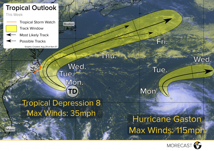
Tropical Depression 8 is continuing to drift toward the Carolina coast. With tropical storm watches issued for the Outer Banks, what impacts can be expected in the Southeast?
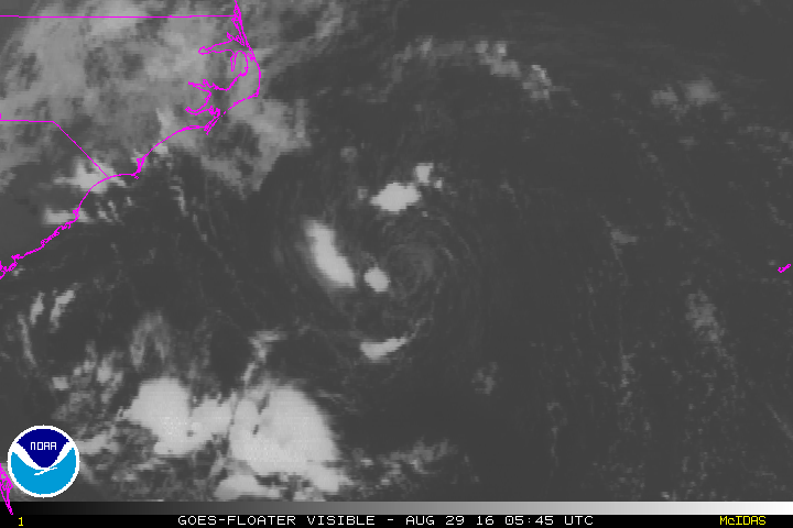
Tropical Depression #8 is currently being sheared by strong easterly winds. Note in the graphic below how the colder thunderstorm cloud tops (the wispy white) is having a hard time developing around the low level swirl. This shear is expected to continue as the storm approaches land. Despite favorable sea surface temperatures and ample moistuer, this shear should prevent the depression from rapidly intensifying as it moves steadily northwestward towards the Carolina coast.
Even without rapid development, there’s a good chance that at least a minimal tropical storm could impact eastern North Carolina, especially the Outer Banks, later this week. This storm likely won’t make a direct landfall, but tropical storm force winds will likely impact the Outer Banks and North Carolina coast, prompting the National Hurricane Center to issue a tropical storm watch. These areas will probably still see gusty winds, heavy rainfall, large waves and abnormally high tides leading to some minor beach erosion. These impacts could be felt as early as Monday night, increasing for Tuesday. By later Wednesday and beyond, the system will turn back out to sea, passing well south of New England.
The beauty that is Hurricane Gaston is reaching its peak intensity and beginning its easterly turn. This storm will not affect the Americas in any way, but will likely bring some rain and winds to northern Europe.
We’ll keep a close eye on this system (as well as Tropical Depression 9) over the next few days and issue updates as needed over our Facebook and Twitter feeds. Listen for important information over your local emergency broadcast networks as well!