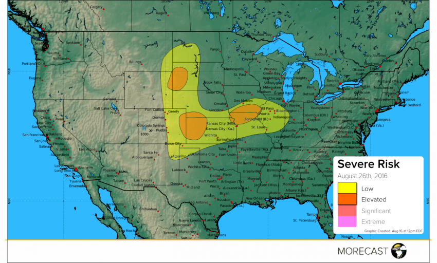
Today’s severe weather will push a bit further north and west across the Plains and Midwest. A combination of a warm front and trough will be the main ingredients for severe storms today.
A combination of an upper level-surface trough stretching across the Western Plains and formation of leeside lows will help spark some severe storms this afternoon and evening. To the east, a warm front stretches from the Plains into the Midwest. Along the front, there will be another elevated risk of severe storms this afternoon and evening across northeastern Kansas, northern Missouri, and southern Iowa . The main hazards with any severe storm will include hail up to 1.5″, wind gusts up to 70 mph, isolated tornadoes, and localized flash flooding.
We’ll continue to issue updates over our social media feeds (Twitter and Facebook) as long as the storms pose a potential threat. Also, don’t forget to upload any pictures to the MORECAST app of storm damage as long as it is safe to do so.