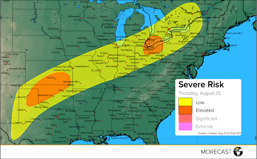
Today’s severe weather continues after yesterday’s fairly tornado active day in Indiana and Ohio. A cold front will be moving through the country which will trigger more storms today.
A low pressure system is currently north of Michigan and a second low pressure system is in Kansas. There is ample moisture and instability that will be the main factor to allow storms to continue to strengthening through the day. The main threat is wind along all risk areas with large hail possible in the ‘elevated’ risk area across the Plains. An isolated tornado is possible to spin up across the ‘elevated’ risk area in Ohio but strong winds is the main hazard. Storms will start to develop through the Panhandle of Texas around 2 pm CDT which will move to the northeast into Kansas through the night.
We’ll continue to issue updates over our social media feeds (Twitter and Facebook) as long as the storms pose a potential threat. Also, don’t forget to upload any pictures to the MORECAST app of storm damage as long as it is safe to do so.