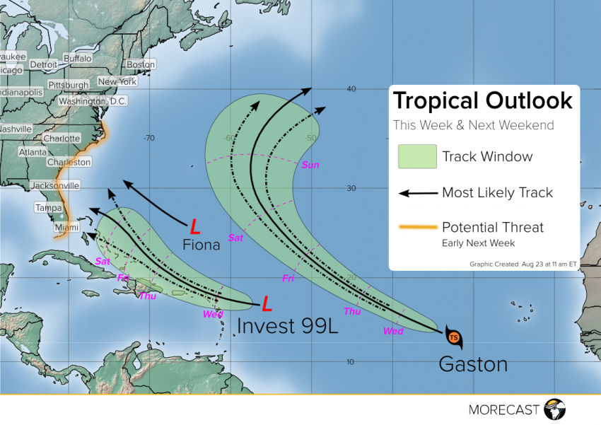
Residents along the southeast US coast should pay close attention to the development of a tropical disturbance now approaching the Leeward Islands. While this system remains disorganized for now, conditions are favorable for it to intensify as it approaches the Bahamas later this week, and there is the potential for a US landfall Sunday or Monday.
Former tropical storm Fiona has degraded to an open wave and will pose no further threat to landmasses. Over the open Atlantic, Tropical Storm Gaston (near right edge of satellite animation below) is gaining strength and may become a hurricane over the next few days. However, Gaston’s track as indicated by virtually all the model guidance takes it over open waters, curving north and then northeast and perhaps eventually approaching Europe as an extratropical cyclone next week.
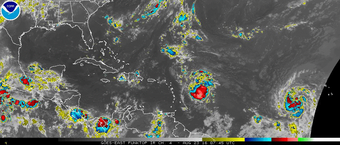
Attention now turns to a system that has yet to even be upgraded to tropical depression, known for now as Invest 99L (near center of above satellite animation). A hurricane hunter flight is currently investigating this disturbance and that new data will give us a better idea of the future prospects for intensification. Over the next day or two, conditions will remain marginally favorable and significant strengthening is unlikely. However, from Thursday into the weekend, the system will be moving into an environment featuring warmer sea surface temperatures and lower vertical wind shear more conducive to development. Some of the models respond to this change by intensifying the system as it approaches the southeast US coast, but we’re far from having a good consensus that would build our confidence in this outcome. At this point the best advice for residents in the potential threat zone would be to keep an eye on government and local sources of weather information and be aware of shelter options and evacuation routes.
We’ll be issuing updates as well over our social media feeds (Twitter and Facebook) so stay tuned!